Futtsu
- Futtsu
-
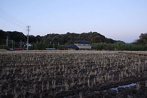
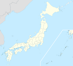
Futtsu (富津市, Futtsu-shi) est une ville (市, shi) de la préfecture de Chiba, au Japon. La ville a été fondée le 1er septembre 1971. La population de la ville est de 48 038 habitants pour une superficie de 205.35 km² (2010).
Liens externes
Sur les autres projets Wikimedia :
Wikimedia Foundation.
2010.
Contenu soumis à la licence CC-BY-SA. Source : Article Futtsu de Wikipédia en français (auteurs)
Regardez d'autres dictionnaires:
Futtsu — shi 富津市 Geographische Lage in Japan … Deutsch Wikipedia
Futtsu — Original name in latin Futtsu Name in other language Futtso, Futtsu State code JP Continent/City Asia/Tokyo longitude 35.30528 latitude 139.81861 altitude 5 Population 51650 Date 2012 01 19 … Cities with a population over 1000 database
Futtsu, Chiba — nihongo|Futtsu|富津市|Futtsu shi is a city located in Chiba, Japan.As of 2003, the city has an estimated population of 51,528 and the density of 251.17 persons per km². The total area is 205.15 km².The city was founded on September 1,… … Wikipedia
Futtsu (Chiba) — Localización de en la Prefectura de Chiba … Wikipedia Español
Futtsu Tateyama Road — Infobox road highway name = Futtsu Tateyama Road (富津館山道路) marker length = 19.2 km [cite web| url= http://www.e nexco.co.jp/more expressway/data/ | title= E NEXCO Expressway Data | accessdate= 2008 04 13 ] established = 1999 first open = starting… … Wikipedia
Futtsu-shi — Admin ASC 2 Code Orig. name Futtsu shi Country and Admin Code JP.04.1863711 JP … World countries Adminstrative division ASC I-II
Tateyama Expressway — Infobox road highway name = Tateyama Expressway (館山自動車道) marker length = 55.7 km [cite web| url= http://www.e nexco.co.jp/more expressway/data/ | title= E NEXCO Expressway Data | accessdate= 2008 04 16 ] established = 1995 [cite web| url=… … Wikipedia
Hamada Yasukazu — Yasukazu Hamada (jap. 浜田 靖一, Hamada Yasukazu; * 21. Oktober 1955 in Futtsu, Präfektur Chiba) ist ein japanischer Politiker der Liberaldemokratischen Partei (LDP), Abgeordneter des Shūgiin, des Unterhauses, und seit September 2008… … Deutsch Wikipedia
Kamogawa (Chiba) — 鴨川市 Kamogawa shi Geographische Lage in Japan … Deutsch Wikipedia
Tokyo Bay — nihongo|Tokyo Bay|東京湾|Tōkyō wan is a bay in the southern Kantō region of Japan. Its old name was nihongo|Edo Bay|江戸湾|Edo wan.GeographyTokyo Bay is surrounded by the Boso Peninsula (Chiba Prefecture) to the east and the Miura Peninsula (Kanagawa… … Wikipedia