Confluence Park
- Confluence Park
-
39° 45′ 11″ N 105° 00′ 42″ W / 39.752997, -105.011766
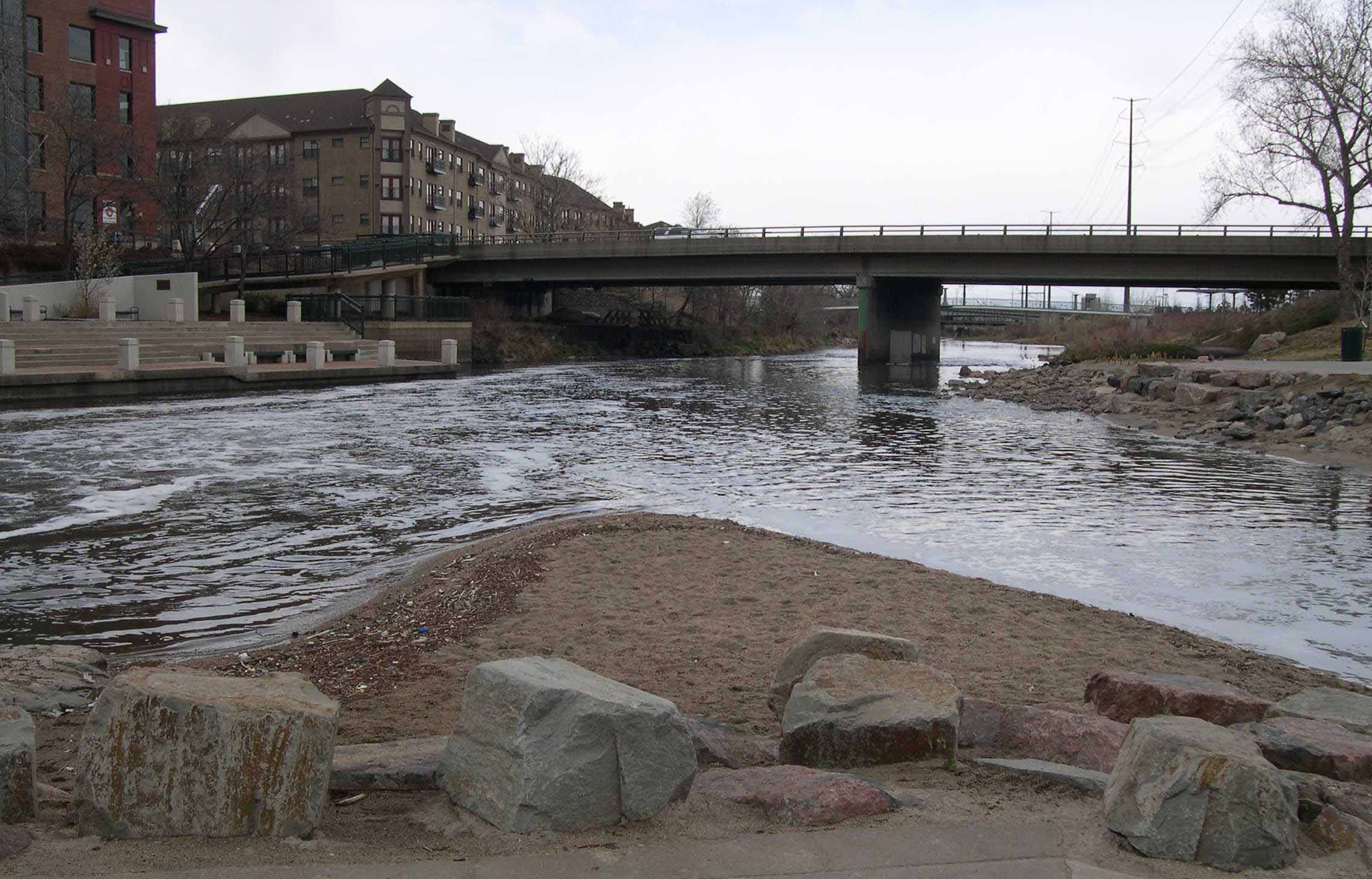
Confluence Park est un parc qui se situe à la jonction entre le cours d'eau Cherry Creek et la rivière South Platte au niveau du quartier de LoDo à Denver.
Le parc est équipé de sentiers bétonnés pour les piétons et les cyclistes. Des pelouses et des parterres avec vue sur les rivières garnissent le parc. Des ponts pour piétions permettent de traverser la rivière South Platte. Il est également possible de faire du kayak sur cette rivière. D'un côté, le parc est proche de zones résidentielles composées de maisons et d'appartements récents et de l'autre côté se situe un parc pour faire du skate.
Wikimedia Foundation.
2010.
Contenu soumis à la licence CC-BY-SA. Source : Article Confluence Park de Wikipédia en français (auteurs)
Regardez d'autres dictionnaires:
Confluence Park — Confluence of the South Platte and Cheery Creek near downtown Denver Type Urban Park Location Denver, Colorado … Wikipedia
Confluence Project — See Degree Confluence Project for the quest to find the intersections of whole number latitude and longitude. The Confluence Project is a series of outdoor installations and interpretive artworks located in public parks along the Columbia River… … Wikipedia
Confluence Greenway — The Confluence Greenway is a 200 square mile (520 km2) system of parks, conservation and recreation areas located in the St. Louis, Missouri metropolitan area. Various parks, trails, and attractions are located along forty miles of both the… … Wikipedia
Confluence, Pennsylvania — For other uses, see Confluence (disambiguation). Confluence, Pennsylvania Borough … Wikipedia
Confluence Trail — The Confluence Trail, part of the Madison County, Illinois Transit (MCT) bikeways network, is an 18.6 mile bike trail between Granite City and Alton, Illinois s Russell Commons Park. The majority of the trail is paved asphalt on top of the… … Wikipedia
Tablas de Daimiel National Park — ▪ park, Spain nature reserve and wetland ecosystem, located about 19 miles (30 km) northeast of the city of Ciudad Real, south central Spain. The park, created in 1973, occupies 4,633 acres (1,875 hectares) and lies at the confluence of the … Universalium
Jones-Confluence Point State Park — is a Missouri state park located on the north side of the Missouri River at its confluence with the Mississippi River, approximately 8 miles north of the St. Louis Arch. The park was opened May 9, 2004, and includes 1,118 acres (4.5 km sup2;) of… … Wikipedia
Fall Creek Falls State Park — Infobox park park=Fall Creek Falls State Park image size=200px caption= type=Tennessee State Park location=Pikeville, Tennessee coordinates= size=convert|20000|acre|km2 opened=1935 operator=Tennessee Department of Environment and Conservation… … Wikipedia
National Register of Historic Places listings in Capitol Reef National Park — This is a list of the National Register of Historic Places listings in Capitol Reef National Park. This is intended to be a complete list of the properties and districts on the National Register of Historic Places in Capitol Reef National Park,… … Wikipedia
Shikellamy State Park — Geobox Protected Area name = Shikellamy State Park native name = other name = other name1 = category local = Pennsylvania State Park category iucn = III image caption = The entrance to Shikellamy State Park s scenic overlook etymology type =… … Wikipedia
 Vue de Confluence Park.