Cité de Nedlands
- Cité de Nedlands
-
31° 58′ 00″ S 115° 48′ 00″ E / -31.9667, 115.8
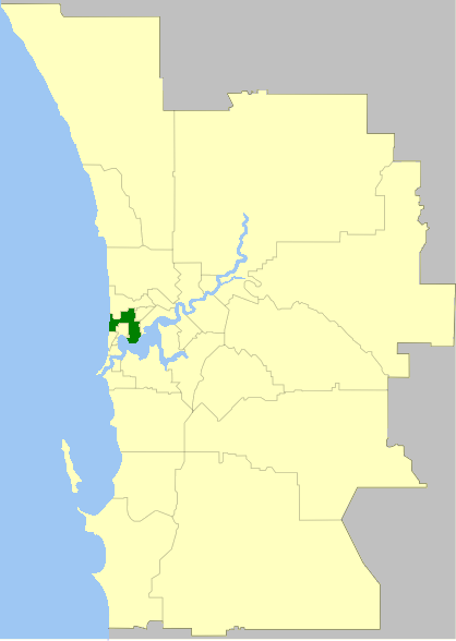
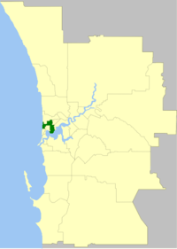
La Cité de Nedlands (City of Nedlands en anglais) est une zone d'administration locale dans la banlieue de Perth en Australie-Occidentale en Australie à environ 7 kilomètres à l'ouest du centre ville.
La zone est divisée en un certain nombre de localités:
- Dalkeith
- Floreat
- Karrakatta
- Mount Claremont
- Nedlands
- Shenton Park
La zone a 12 conseillers et est découpée en 4 circonscriptions.
- Coastal Ward
- Dalkeith Ward
- Hollywood Ward
- Melvista Ward
Lien externe
Catégorie :
- Zone d'administration locale de Perth
Wikimedia Foundation.
2010.
Contenu soumis à la licence CC-BY-SA. Source : Article Cité de Nedlands de Wikipédia en français (auteurs)
Regardez d'autres dictionnaires:
Ville de Nedlands — Cité de Nedlands Cité de Nedlands Géographie État : Australie Occidentale Région : Perth … Wikipédia en Français
Electoral district of Nedlands — Infobox Australian Electorate name = Nedlands state = wa caption = lifespan = 1930–present mp = Sue Walker mp party = Independent namesake = Nedlands area = 26.7 class = North MetropolitanThe Electoral district of Nedlands is a Legislative… … Wikipedia
Zones d'administration locale d'Australie-Occidentale — Les zones d administration locales d Australie Occidentale Il y a 141 zones d administration locale en Australie Occidentale si l on tient compte des deux comtés que sont le comté de l île Christmas et le comté des îles Cocos. Les fonctions de… … Wikipédia en Français
Contenu:Australie — Projet:Australie/Liste des articles Liste mise à jour régulièrement par MyBot (d · c · b) à partir des articles liés au bandeau {{Portail Australie}} Modifications récentes des articles ayant le bandeau de ce portail… … Wikipédia en Français
Richard Court — Infobox President name =Richard Court nationality =Australian caption = order =26th Premier of Western Australia term start =16 February, 1993 term end =10 February 2001 deputy =Hendy Cowan, Colin Barnett predecessor =Carmen Lawrence successor… … Wikipedia
Yagan — (IPAEng|ˈjeɪgən; rhymes with pagan ) (c. 1795 – 11 July 1833) was a Noongar warrior who played a key part in early indigenous Australian resistance to European settlement and rule in the area of Perth, Western Australia. After he led a series of… … Wikipedia
George Hampton — George Essex Hampton (c. 1838–1876) was an unpopular public official in colonial Western Australia.The son of Governor of Western Australia Dr John Hampton, George Hampton arrived in the colony with his father in February 1862 on board the… … Wikipedia
Stirling Highway — Infobox Australian Road road name = Stirling Highway route route route photo = caption = length = 13 direction = Northeast Southwest start = finish = est = 1930s through = Nedlands, Claremont, Cottesloe, Mosman Park, North Fremantle route = part… … Wikipedia
Karrinyup Shopping Centre — infobox shopping mall shopping mall name = Karrinyup Shopping Centre image width = 200px caption = location = Karrinyup, Western Australia, Australia coordinates = coord| 31.875|115.784|display=inline|format=dms opening date = 17 September 1973… … Wikipedia
AmpFest — Clash of the Bands is an initiative of a West Australian Youth Advisory Council (YAC) and has been held in May each year since 2003 by five Councils, in the western suburbs of Perth, comprising of City of Nedlands, Town of Claremont, Town of… … Wikipedia
 Australie