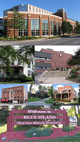
Blue Island (Illinois)
Contenu soumis à la licence CC-BY-SA. Source : Article Blue Island (Illinois) de Wikipédia en français (auteurs)
Regardez d'autres dictionnaires:
Blue Island, Illinois — Chicagoland municipality muni name = Blue Island village = 1836 muni = City date = 1901 state = Illinois county = Cook tcounty = Cook tcounty2 = Cook tcounty3 = Cook township = Worth township2 = Calumet township3 = Bremen township4 = Thornton gov … Wikipedia
Dwight D. Eisenhower High School (Blue Island, Illinois) — Dwight D. Eisenhower High School Address 12700 S. Sacramento Avenue Blue Island, Illinois, 60406 USA … Wikipedia
Eisenhower High School (Blue Island, Illinois) — Infobox Secondary school name = Dwight D. Eisenhower High School principal = Joe Fowler type = Public secondary grades = 9–12 city = 12700 Sacramento Ave Blue Island state = Illinois country = United States enrollment = 1,600 campus = Suburban… … Wikipedia
Blue Island (Metra) — Infobox Station name=Blue Island type=Metra regional rail image size= image caption= address=2300 West Grove Street Blue Island, IL coordinates= line=Rail color box|system=Metra|line=Metra Electric other=Pace Bus structure= platform=1 Center… … Wikipedia
Blue Island Avenue — is a diagonal street in the city of Chicago, Illinois that once led to a ridge of land that early pioneers gave the name Blue Island because at a distance it looked like an island in the prairie. The blue color has attributed to atmospheric… … Wikipedia
Blue Island — Blue Island, IL U.S. city in Illinois Population (2000): 23463 Housing Units (2000): 8750 Land area (2000): 4.029781 sq. miles (10.437085 sq. km) Water area (2000): 0.094826 sq. miles (0.245597 sq. km) Total area (2000): 4.124607 sq. miles… … StarDict's U.S. Gazetteer Places
Blue Island, IL — U.S. city in Illinois Population (2000): 23463 Housing Units (2000): 8750 Land area (2000): 4.029781 sq. miles (10.437085 sq. km) Water area (2000): 0.094826 sq. miles (0.245597 sq. km) Total area (2000): 4.124607 sq. miles (10.682682 sq. km)… … StarDict's U.S. Gazetteer Places
Blue Island — (spr. blū ailǟnd), Dorf im nordamerikan. Staat Illinois, Grafschaft Cook, südwestlich von Chicago, mit Schmelzwerk, Steinbrüchen und (1906) 6114 Einwohnern … Meyers Großes Konversations-Lexikon
123rd Street - Blue Island (Metra) — Infobox Station name=123rd Street Blue Island type=Metra regional rail image size= image caption= address=2120 West 123rd Street Blue Island, Illinois coordinates= line=Rail color box|system=Metra|line=Rock Island other= structure= platform=Yes… … Wikipedia
119th Street - Blue Island (Metra) — Infobox Station name=119th Street Blue Island type=Metra regional rail image size= image caption= address=2040 West 119th Street Blue Island, Illinois coordinates= line=Rail color box|system=Metra|line=Rock Island other= structure= platform=Yes… … Wikipedia
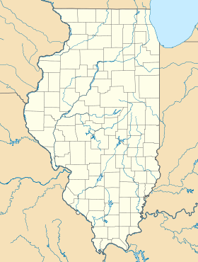
 États-Unis
 Illinois