Zvirnjača

Zvirnjača

43° 49′ 00″ N 17° 21′ 53″ E / 43.8167, 17.3647

Zvirnjača
Administration
Pays Drapeau de Bosnie-Herzégovine Bosnie-Herzégovine
Entité Drapeau de la Fédération de Bosnie-et-Herzégovine Fédération de Bosnie-et-Herzégovine
Canton Bosnie de l'ouest
Municipalité Kupres
Géographie
Coordonnées 43° 49′ 00″ Nord
       17° 21′ 53″ Est
/ 43.8167, 17.3647
Démographie
Population 317 hab. (1991)
Localisation
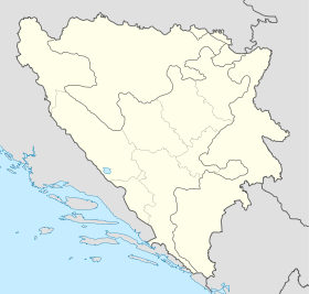
Bosnia and Herzegovina location map.svg
City locator 15.svg
Zvirnjača

Zvirnjača (en cyrillique : Звирњача) est un village de Bosnie-Herzégovine. Il est situé dans la municipalité de Kupres et dans le canton de Bosnie de l'ouest, Fédération de Bosnie-et-Herzégovine. Au recensement de 1991, il comptait 317 habitants, dont une majorité de Croates[1].

Sommaire

Démographie

Répartition de la population (1991)

Nationalité Nombre %
Croates 314 99,05
Serbes 2 0,63
Inconnus/autres 1 0,31[1]

Notes et références

  1. a et b (bs)(hr)(sr) Livre : Composition nationale de la population - Résultats de la République par municipalités et localités 1991, Bulletin statistique n°234, Publication de l'Institut national de statistique de Bosnie-Herzégovine, Sarajevo.

Voir aussi

Articles connexes

Liens externes


Wikimedia Foundation. 2010.

Contenu soumis à la licence CC-BY-SA. Source : Article Zvirnjača de Wikipédia en français (auteurs)

Игры ⚽ Поможем написать курсовую

Regardez d'autres dictionnaires:

  • Zvirnjaca — Zvirnjača ist ein überwiegend kroatisch bevölkertes Dorf in der Gemeinde Kupres in Südwestbosnien. Es liegt an der Grenze zur Gemeinde Prozor Rama, die in der Herzegowina liegt. Zvirnjača wurde auch vor dem Krieg hauptsächlich von Kroaten bewohnt …   Deutsch Wikipedia

  • Zvirnjača — ist ein überwiegend kroatisch bevölkertes Dorf in der Gemeinde Kupres in Südwestbosnien. Es liegt an der Grenze zur Gemeinde Prozor Rama, die in der Herzegowina liegt. Zvirnjača wurde auch vor dem Krieg hauptsächlich von Kroaten bewohnt. Einige… …   Deutsch Wikipedia

  • Kupres — Pour les articles homonymes, voir Kupres (homonymie). 43° 59′ 34″ N 17° 16′ 39″ E …   Wikipédia en Français

  • List of settlements in Bosnia and Herzegovina — This is a complete list of settlements in Bosnia and Herzegovina, as recorded by 1991 census, sorted by municipalities. Town of Sarajevo = Sarajevo Centar = • Mrkovići • Nahorevo• Poljine• Radava• Sarajevo (part of settlement)• Vića Sarajevo… …   Wikipedia

  • Gornje Ravno — ist ein serbisches Dorf im Südosten der Gemeinde Kupres im Westen von Bosnien und Herzegowina. Es liegt im Tal Ravanjsko polje, welches eines der Täler des Kupresko polje darstellt. Im Ort leben fast ausschließlich Serben. Etwas südöstlich von… …   Deutsch Wikipedia

  • Kupres — Купрес …   Deutsch Wikipedia

  • Kupres (Federación de Bosnia-Herzegovina) — Kupres Kupres Organización territorial de la Federación de Bosnia y Herzegovina de Bosnia y Herzegovina …   Wikipedia Español

  • Barjamovci — 44° 03′ 04″ N 17° 06′ 50″ E / 44.051, 17.114 …   Wikipédia en Français

  • Begovo Selo — 43° 59′ 22″ N 17° 17′ 23″ E / 43.9894, 17.2897 …   Wikipédia en Français

  • Bili Potok — 44° 04′ 00″ N 17° 13′ 56″ E / 44.0667, 17.2322 …   Wikipédia en Français

Share the article and excerpts

Direct link
Do a right-click on the link above
and select “Copy Link”