Wythenshawe
- Wythenshawe
-
53° 23′ 32″ N 2° 15′ 50″ W / 53.3923, -2.264
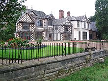
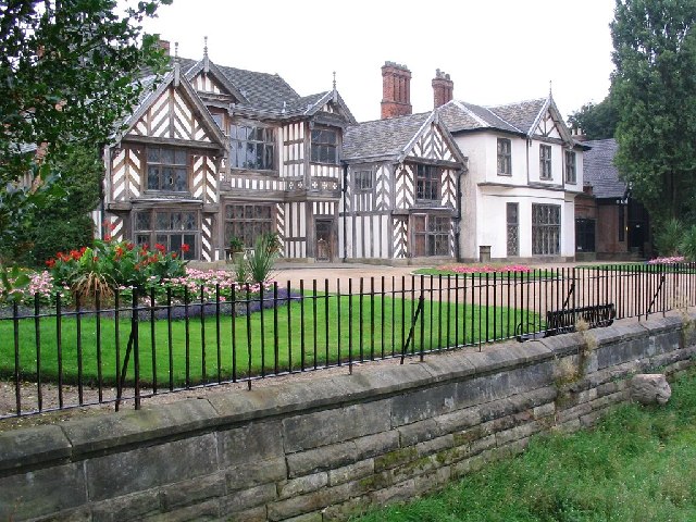
Le Wythenshave Hall, une bâtisse datant du
XVIe siècle.
Wythenshawe est un district du sud de Manchester, en Angleterre, qui abrite 66 000 habitants.
Jusqu'en 1931 le district fait partie du comté du Cheshire, mais il est ensuite transféré à celui de la ville de Manchester qui a commencé à y bâtir des logements sociaux à partir de 1920 pour enrayer le développement des bidonvilles.
Le district est composé des quartiers de Baguley, Benchill, Peel Hall, Newall Green, Woodhouse Park, Moss Nook, Sharston, Northenden et Northern Moor.
Wikimedia Foundation.
2010.
Contenu soumis à la licence CC-BY-SA. Source : Article Wythenshawe de Wikipédia en français (auteurs)
Regardez d'autres dictionnaires:
Wythenshawe — infobox UK place country = England map type= Greater Manchester official name= Wythenshawe population= 66,267 (2001 Census) latitude= 53.3923 longitude= 2.264 metropolitan borough= City of Manchester metropolitan county= Greater Manchester region … Wikipedia
Wythenshawe FM — Radio station name = WFM airdate = 6th May 2002 frequency = 97.2 MHz, [http://www.wfmradio.org Online] area = Manchester format = Community owner = Radio regen Wythenshawe FM 97.2 also known as WFM is a community radio station broadcasting… … Wikipedia
Wythenshawe Hall — is a 16th century medieval timber framed historic house and a former stately home in Wythenshawe, Manchester, England. It is located east of Altrincham and south of Stretford, five miles (8 km) south of Manchester city centre, in Wythenshawe Park … Wikipedia
Wythenshawe bus station — was opened by the Greater Manchester Passenger Transport Executive in 1981. It is mainly served by operators Stagecoach Manchester and Arriva. Most buses that call here also provide links to Manchester Airport. Wythenshawe Bus Station can be… … Wikipedia
Wythenshawe Amateurs F.C. — Wythenshawe Amateurs F.C. are an English association football club, formed in 1946. They are based in Wythenshawe, a district of Manchester, and currently play in the Manchester Football League Premier Division. Their home ground is Longley Lane… … Wikipedia
Wythenshawe and Sale East (UK Parliament constituency) — UK constituency infobox Name = Wythenshawe and Sale East Map1 = WythenshaweSaleEast Map2 = GreaterManchester Entity = Greater Manchester Type = Borough County = Greater Manchester Year = 1997 MP = Paul Goggins Party = Labour EP = North West… … Wikipedia
Wythenshawe Hospital — Infobox Hospital Name = University Hospital of South Manchester Org/Group = South Mancheser University Hospitals NHS Trust Width = Caption = Location = Wythenshawe Region = Manchester State = England Country = UK HealthCare = NHS Type = General… … Wikipedia
Manchester (Wythenshawe) Aerodrome — Coordinates: 53°24′36″N 2°16′48″W / 53.4099°N 2.2801°W / 53.4099; 2.2801 … Wikipedia
Manchester Wythenshawe (UK Parliament constituency) — Coordinates: 53°23′49″N 2°16′08″W / 53.397°N 2.269°W / 53.397; 2.269 … Wikipedia
Baron Simon of Wythenshawe — Baron Simon of Wythenshawe, of Didsbury in the City of Manchester, is a title in the Peerage of the United Kingdom. It was created in 1947 for Ernest Simon, an industrialist and politician. He had previously served as a member of the Manchester… … Wikipedia