Waw an Namus
- Waw an Namus
-
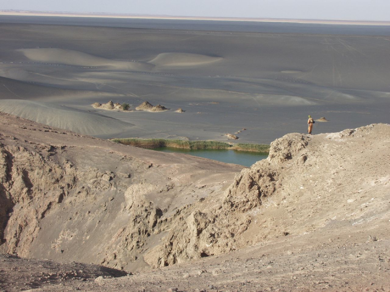
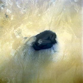
Le Waw an Namus, en arabe واو الناموس, littéralement « Oasis des Moustiques », est une caldeira de Libye comportant un cône volcanique et de petits lacs. Il est situé dans le Sud du pays, dans le Sahara, dans le shabiyah de Murzuq.
Lien externe
Sur les autres projets Wikimedia :
Wikimedia Foundation.
2010.
Contenu soumis à la licence CC-BY-SA. Source : Article Waw an Namus de Wikipédia en français (auteurs)
Regardez d'autres dictionnaires:
Waw an Namus — Waw an Namus, aufgenommen aus dem Space Shuttle, 25. Oktober 1992 Höhe … Deutsch Wikipedia
Waw an-Namus — Waw an Namus, aufgenommen aus dem Space Shuttle, 25. Oktober 1992 Höhe … Deutsch Wikipedia
Waw an Namus — Infobox Mountain Name=Waw an Namus Photo=Waw An Namus STS052.jpg Caption=Waw An Namus, viewed from the Space Shuttle, 25 October 1992 Elevation=547 metres (1,795 feet) Location=Libya Prominence = Coordinates = coord|24|54|N|17|45|E|type:mountain… … Wikipedia
Namus (disambiguation) — Namus is an ethical category of respect and honor in some Middle Eastern societies Namus may also refer to: A person: Abdullah bin Namus, the Moroccan commander for the United Nations during the June 1993 destruction of the headquarters of… … Wikipedia
Harūj al-Aswad, Al- — ▪ plateau, Libya hilly basaltic plateau of central Libya. A startlingly black expanse with an area of some 15,500 square miles (40,150 square km), it rises out of the surrounding sand to about 2,600 feet (800 metres) and is crowned by a… … Universalium
Liste von Vulkanen — Karte mit allen Koordinaten: OSM, Google oder … Deutsch Wikipedia
Вау-ан-Намус — араб. واو الناموس … Википедия
Jebel Uweinat — The Mountain Uwaynat on the border of Egypt, Libya, Sudan Jebel Uweinat (1,934 m; جبل العوينات gabal al ʿuwaināt mountain of sourcelets ; also spelled Jabal, Djebel Al Awaynat, Auenat, Ouenat, Ouinat, Owainat, Oweinat, Uwaynat, Uweinat … Wikipedia
Caldera (Krater) — Caldera (9,5 km Durchmesser und 600 m Tiefe) des Vulkans Mount Aniakchak in Alaska mit darin gebildetem kleineren Vulkankegel … Deutsch Wikipedia
Trou au Natron — und Tousside (Süden und Caldera sind oben) Höhe … Deutsch Wikipedia
 Libye
Libye


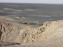 Paysage du Waw an Namus.