Velji Lug

Velji Lug

43° 48′ 12″ N 19° 18′ 26″ E / 43.8033, 19.3072

Velji Lug
Вељи Луг
Administration
Pays Drapeau de Bosnie-Herzégovine Bosnie-Herzégovine
Entité Drapeau de la république serbe de Bosnie République serbe de Bosnie
Municipalité Višegrad
Géographie
Coordonnées 43° 48′ 12″ Nord
       19° 18′ 26″ Est
/ 43.8033, 19.3072
Démographie
Population 310 hab. (1991)
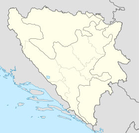
Localisation
Bosnia and Herzegovina location map.svg
City locator 15.svg
Velji Lug

Velji Lug (en serbe cyrillique : Вељи Луг) est un village de Bosnie-Herzégovine. Il est situé dans la municipalité de Višegrad, République serbe de Bosnie. Au recensement de 1991, il comptait 310 habitants, dont une majorité de Serbes[1].

Sommaire

Démographie

Répartition de la population (1991)

Nationalité Nombre %
Serbes 164 52,90
Musulmans 142 45,81
Inconnus/Autres 4 1,29[1]

Notes et références

  1. a et b (bs)(hr)(sr) Livre : Composition nationale de la population - Résultats de la République par municipalités et localités 1991, Bulletin statistique n°234, Publication de l'Institut national de statistique de Bosnie-Herzégovine, Sarajevo.

Voir aussi

Articles connexes

Liens externes


Wikimedia Foundation. 2010.

Contenu soumis à la licence CC-BY-SA. Source : Article Velji Lug de Wikipédia en français (auteurs)

Игры ⚽ Поможем решить контрольную работу

Regardez d'autres dictionnaires:

  • List of settlements in Bosnia and Herzegovina — This is a complete list of settlements in Bosnia and Herzegovina, as recorded by 1991 census, sorted by municipalities. Town of Sarajevo = Sarajevo Centar = • Mrkovići • Nahorevo• Poljine• Radava• Sarajevo (part of settlement)• Vića Sarajevo… …   Wikipedia

  • Višegrad — Pour les articles homonymes, voir Visegrad. 43° 47′ 05″ N 19° 17′ 57″ E …   Wikipédia en Français

  • Nićifor Dučić — Archimandrite Nićifor Dučić (Serbian Cyrillic: Нићифор Дучић)(1832–1900), , was a member of the golden pleiad of the Serbs from Herzegovina, theologian, historian and philologist who was educated in Belgrade and Paris, monk who refused the title… …   Wikipedia

  • Brodar — 43° 44′ 36″ N 19° 12′ 10″ E / 43.7433, 19.2028 …   Wikipédia en Français

  • Gornje Štitarevo — 43° 55′ 19″ N 19° 11′ 26″ E / 43.9219, 19.1906 …   Wikipédia en Français

  • Međeđa (Višegrad) — Pour les articles homonymes, voir Međeđa. 43° 43′ 56″ N 19° 10′ 40″ E …   Wikipédia en Français

  • Orahovci — Ораховци Administration Pays …   Wikipédia en Français

  • Resnik (Višegrad) — Pour les articles homonymes, voir Resnik. 43° 50′ 35″ N 19° 14′ 05″ E …   Wikipédia en Français

  • Sase (Višegrad) — Pour les articles homonymes, voir Sase. 43° 49′ 00″ N 19° 16′ 53″ E …   Wikipédia en Français

  • Đurevići — 43° 53′ 12″ N 19° 12′ 39″ E / 43.8867, 19.2108 …   Wikipédia en Français

Share the article and excerpts

Direct link
Do a right-click on the link above
and select “Copy Link”