Varoška Rijeka

Varoška Rijeka

45° 05′ 05″ N 16° 00′ 51″ E / 45.0847, 16.0142

Varoška Rijeka
Administration
Pays Drapeau de Bosnie-Herzégovine Bosnie-Herzégovine
Entité Drapeau de la Fédération de Bosnie-et-Herzégovine Fédération de Bosnie-et-Herzégovine
Canton Una-Sana
Municipalité Bužim
Géographie
Coordonnées 45° 05′ 05″ Nord
       16° 00′ 51″ Est
/ 45.0847, 16.0142
Démographie
Population 4 992 hab. (1991)
Localisation
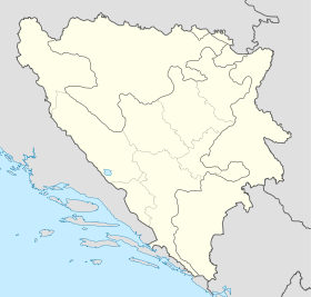
Bosnia and Herzegovina location map.svg
City locator 15.svg
Varoška Rijeka

Varoška Rijeka (en cyrillique : Варошка Ријека) est une localité de Bosnie-Herzégovine. Elle est située dans la municipalité de Bužim et dans le canton d'Una-Sana, Fédération de Bosnie-et-Herzégovine. Au recensement de 1991, elle comptait 4 992 habitants, dont une majorité de Musulmans (Bosniaques)[1],[2].

Sommaire

Histoire

Avant la guerre de Bosnie-Herzégovine, la localité de Varoška Rijeka faisait partie de la municipalité de Bosanska Krupa ; elle a été ensuite rattachée à la municipalité nouvellement créée de Bužim qui, comme Bosanska Krupa, est intégrée à la Fédération de Bosnie-et-Herzégovine.

Démographie

Répartition de la population (1991)

Nationalité Nombre %
Musulmans 4 942 98,99
Yougoslaves 8 0,16
Serbes 4 0,08
Inconnus/autres 38 0,76[1],[2]

Notes et références

  1. a et b (bs)(hr)(sr) Livre : Composition nationale de la population - Résultats de la République par municipalités et localités 1991, Bulletin statistique n°234, Publication de l'Institut national de statistique de Bosnie-Herzégovine, Sarajevo.
  2. a et b (bs)(hr)(sr)[PDF] Recensement par communautés locales sur http://www.fzs.ba, Bosnie-Herzégovine - Fédération de Bosnie-et-Herzégovine - Institut fédéral de statistique. Consulté le 11 octobre 2010

Voir aussi

Articles connexes

Liens externes


Wikimedia Foundation. 2010.

Contenu soumis à la licence CC-BY-SA. Source : Article Varoška Rijeka de Wikipédia en français (auteurs)

Игры ⚽ Нужно сделать НИР?

Regardez d'autres dictionnaires:

  • Varoška Rijeka — Sp Vãroška Rijeka Ap Varoška Rijeka L Bosnija ir Hercegovina …   Pasaulio vietovardžiai. Internetinė duomenų bazė

  • Varoska Rijeka — Original name in latin Varoka Rijeka Name in other language Varoska Rijeka, Varoka Rijeka State code BA Continent/City Europe/Sarajevo longitude 45.08936 latitude 16.01906 altitude 193 Population 6573 Date 2012 02 28 …   Cities with a population over 1000 database

  • Bužim — is a village and municipality situated in the most northwestern Bosnia and Herzegovina. Administratively, it is part of the Una Sana Canton.GeographyBužim borders Bosanska Krupa to the east, Cazin to the south, Velika Kladuša to the west and… …   Wikipedia

  • List of settlements in Bosnia and Herzegovina — This is a complete list of settlements in Bosnia and Herzegovina, as recorded by 1991 census, sorted by municipalities. Town of Sarajevo = Sarajevo Centar = • Mrkovići • Nahorevo• Poljine• Radava• Sarajevo (part of settlement)• Vića Sarajevo… …   Wikipedia

  • Bosanska Krupa — 44° 52′ 57″ N 16° 09′ 05″ E / 44.8825, 16.1514 …   Wikipédia en Français

  • Bužim (Una-Sana) — Pour les articles homonymes, voir Bužim. 45° 03′ 17″ N 16° 01′ 55″ E …   Wikipédia en Français

  • Bosanska Krupa — Infobox Settlement official name = PAGENAME settlement type = subdivision type = Country subdivision name = BIH timezone=CET utc offset=+1 map caption =Location of PAGENAME within Bosnia and Herzegovina. timezone DST= leader title=Municipality… …   Wikipedia

  • Buzim (Una-Sana) — Bužim (Una Sana) Pour les articles homonymes, voir Bužim. Bužim Бугојно …   Wikipédia en Français

  • Bag (Bužim) — Pour les articles homonymes, voir Bag. 45° 02′ 49″ N 16° 01′ 01″ E …   Wikipédia en Français

  • Dobro Selo (Bužim) — Pour les articles homonymes, voir Dobro Selo. 45° 03′ 25″ N 16° 06′ 47″ E …   Wikipédia en Français

Share the article and excerpts

Direct link
Do a right-click on the link above
and select “Copy Link”