Triyuga
Contenu soumis à la licence CC-BY-SA. Source : Article Triyuga de Wikipédia en français (auteurs)
Regardez d'autres dictionnaires:
Triyuga — (गाइघाट,त्रियुगा,उदयपुर )is in the Udayapur District Sagarmatha zone of eastern Nepal. This city is in the famous Udyapur Valley, Gaighat (other name of Triyuga) is the shadow of a historic kingdom of Sen dynasty in Udayapur Ghadhi (Chaudandi)… … Wikipedia
Inner Terai Valleys of Nepal — The Inner Terai Valleys or Bhitri tarai (भित्री तराइ) are various elongated valleys in Nepal situated between the Himalayan foothills, the 600–900 m high Siwalik or Churia Range and the 2,000 3,000 m high Mahabharat Range further north. Major… … Wikipedia
List of cities in Nepal — This is a list of cities in Nepal.Note: Not all of these localities listed are municipalities. municipalities, of which Nepal momentarily has 58, are marked with a (*). The listed names are the official names of the municipalities, nevertheless… … Wikipedia
Sagarmatha Zone — (सगरमाथा अञ्चल) is a zone in eastern Nepal. This zone includes mountain districts of the Himalayas (including Mount Everest) in the north, hill districts in the center, and valley districts of the Terai in the south. The borders of this zone are… … Wikipedia
Eastern Nepal — is Southwards and includes the highest mountain in the world. CitiesThe major cities of this region are Biratnagar, Rajbiraj, Dharan and Dhankuta. Another notable place is Namche Bazaar, the town near the base camp of Mt. Everest, Gaighat, which… … Wikipedia
7-Parteien-Allianz — संघीय लोकतान्त्रिक गणतन्त्रात्मक नेपाल Saṃghīya Loktāntrik Gaṇatantrātmak Nepāl Demokratische Bundesrepublik Nepal[1] … Deutsch Wikipedia
Demokratische Bundesrepublik Nepal — संघीय लोकतान्त्रिक गणतन्त्रात्मक नेपाल Saṃghīya Loktāntrik Gaṇatantrātmak Nepāl Demokratische Bundesrepublik Nepal[1] … Deutsch Wikipedia
Königreich Nepal — संघीय लोकतान्त्रिक गणतन्त्रात्मक नेपाल Saṃghīya Loktāntrik Gaṇatantrātmak Nepāl Demokratische Bundesrepublik Nepal[1] … Deutsch Wikipedia
Liste der Städte in Nepal — Die Liste der Städte in Nepal bietet einen Überblick über die Entwicklung der Einwohnerzahl aller 58 Gemeinden des südasiatischen Staates Nepal. Die mit Abstand größte Agglomeration in Nepal ist Kathmandu mit einer Einwohnerzahl von 1.264.676… … Deutsch Wikipedia
Nepal — संघीय लोकतान्त्रिक गणतन्त्रात्मक नेपाल Saṃghīya Loktāntrik Gaṇatantrātmak Nepāl Demokratische Bundesrepublik Nepal[1] … Deutsch Wikipedia
 Népal
Népal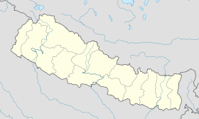
 Triyuga