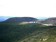
Top of the World Highway
- Top of the World Highway
-
64°13′00″N 140°21′00″O / 64.216667, -140.35 La route appelée Top of the world highway est une route qui relie West Dawson et Dawson City au Yukon à l'Alaska aux États-Unis où elle rejoint la Taylor Highway en passant par la frontière entre Canada et USA. Elle est longue de 105 kilomètres (65 mi).

Poste frontière entre l'Alaska et le Yukon
Cette route existe depuis 1955, et était le seul accès vers Dawson City avant la construction de la Klondike Highway. Elle est fermée en hiver.
Son nom lui vient du fait qu'elle est située en altitude, avec des vues lointaines sur les vallées de part et d'autre. C'est aussi une des routes les plus septentrionales du continent américain.
Un ferry relie West Dawson à Dawson City l'été, tandis que les résidents traversent sur le fleuve gelé l'hiver.
Voir aussi
Wikimedia Foundation.
2010.
Contenu soumis à la licence CC-BY-SA. Source : Article Top of the World Highway de Wikipédia en français (auteurs)
Regardez d'autres dictionnaires:
Top of the World Highway — The Top of the World Highway, 105 kilometres (66 miles) long, connects West Dawson (across the Yukon River from Dawson City) in the Yukon Territory with the Alaska, USA border, and continues for another 13 miles in Alaska, where it then joins the … Wikipedia
Top of the World Highway — 64.22843 140.19049 Koordinaten: 64° 13′ 42″ N, 140° 11′ 26″ W … Deutsch Wikipedia
Top of the World — may refer to:Music* Top of the World (album), an album by Lynn Anderson * Top of the World (The All American Rejects song) * Top of the World (Brandy song) * Top of the World (The Carpenters song), notably covered by Lynn Anderson * Top of the… … Wikipedia
Top-of-the-World, Arizona — Infobox Settlement official name = Top of the World, Arizona settlement type = CDP image caption = imagesize = image caption = imagesize = mapsize = 250px map caption = Location in Gila County and the state of Arizona mapsize1 = map caption1 =… … Wikipedia
The World Is Flat — Infobox Book name = The World Is Flat: A Brief History of the Twenty First Century image caption = Original 1st edition cover author = Thomas Friedman country = United States language = English subject = Globalization publisher = Farrar, Straus… … Wikipedia
Collapse of the World Trade Center — Coordinates: 40°42′41.12″N 74°00′44.00″W / … Wikipedia
List of performances on Top of the Pops — NOTOC Contents 1960s: 1964 | 1965 | 1966 | 1967 | 1968 | 1969 1970s: 1970 | 1971 | 1972 | 1973 | 1974 | 1975 | 1976 | 1977 | 1978 1979 1980s: 1980 | 1981 1982 | 1983 | 1984 1985 | 1986 | 1987 1988 | 1989 1990s: 1990 | 1991 | 1992 | 1993 1994 |… … Wikipedia
The Wildhearts — Datos generales Origen Newcastle upon Tyne, Inglaterra … Wikipedia Español
Not Enough Love in the World — Single by Don Henley from the album Building the Perfect Beast … Wikipedia
The Best of Van Morrison Volume 3 — Álbum recopilatorio de Van Morrison Publicación 11 de junio de 2007 … Wikipedia Español


