Tongala
Contenu soumis à la licence CC-BY-SA. Source : Article Tongala de Wikipédia en français (auteurs)
Regardez d'autres dictionnaires:
Tongala, Victoria — Infobox Australian Place | type = town name = Tongala state = vic caption = Main street lga = Shire of Campaspe postcode = 3621 est = pop = 1623 (2006)Census 2006 AUS | id = SSC26787 | name = Tongala (State Suburb) | accessdate = 2007 10 01 |… … Wikipedia
Tongala Football Club — Infobox aus sport club | clubname = Tongala fullname = Tongala Football Netball Club Inc. emblem = Blues strip = Light Blue with a Navy emblem founded = 1894 sport = Australian rules football league = Murray Football League ground = Tongala… … Wikipedia
Murray Football League — General Information Founded 1931 Current clubs Barooga Cobram Congupna Deniliquin Echuca United Finley Moama Mulwala Nathalia Numurkah … Wikipedia
Murray Valley Highway — Murray Valley Highway … Wikipedia
List of localities in Victoria (Australia) — Map of Local Government Areas in Victoria This is a list of locality names and populated place names in the state of Victoria, Australia, outside the Melbourne metropolitan area. It is organised by region from the south west of the state to the… … Wikipedia
Doug Brown (Australian footballer) — Doug Brown Personal information Full name Douglas Ernest Fewster Brown Date of birth … Wikipedia
Kyabram, Victoria — Infobox Australian Place | type = town name = Kyabram state = vic caption = Main street lga = Shire of Campaspe postcode = 3620 pop = 7108 (2006)Census 2006 AUS | id = SSC25925 | name = Kyabram (State Suburb) | accessdate = 2007 10 01 | quick =… … Wikipedia
Anne McEwen (DBE) — Dame Anne Mills McEwen, née McLeod, DBE (1900 – 10 February 1967), best known as Annie McEwen, was the wife of former Australian Deputy Prime Minister, John McEwen.She was active in the Country Party and devoted her life to working for the public … Wikipedia
Shire of Deakin — Infobox Australian Place | type = lga name = Shire of Deakin state = vic region = area = 961 est = 1893 seat = Tongala pop = 5800 (1992) [cite book|title=Victorian Year Book|author=Australian Bureau of Statistics, Victoria… … Wikipedia
List of localities (Victoria) — This is a list of places in the State of Victoria, Australia. It is presently highly incomplete. For places in the Greater Melbourne area, see List of Melbourne suburbs. Rural and Regional CitiesRural City of Ararat*Ararat *WillauraCity of… … Wikipedia
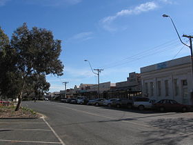 La grand'rue de Tongala
 Australie

