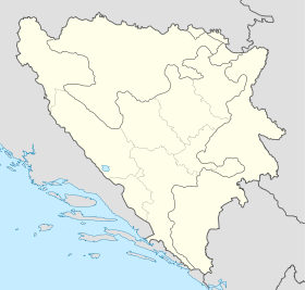
Sijekovac

Sijekovac

45° 07′ 00″ N 17° 58′ 43″ E / 45.1167, 17.9786

Sijekovac
Сијековац
Administration
Pays Drapeau de Bosnie-Herzégovine Bosnie-Herzégovine
Entité Drapeau de la république serbe de Bosnie République serbe de Bosnie
Municipalité Bosanski Brod
Géographie
Coordonnées 45° 07′ 00″ Nord
       17° 58′ 43″ Est
/ 45.1167, 17.9786
Démographie
Population 1 551 hab. (1991)
Localisation
Bosnia and Herzegovina location map.svg
City locator 15.svg
Sijekovac

Sijekovac (en serbe cyrillique : Сијековац) est un village de Bosnie-Herzégovine. Il est situé dans la municipalité de Bosanski Brod, République serbe de Bosnie. Au recensement de 1991, il comptait 1 551 habitants, dont une majorité relative de Musulmans (Bosniaques)[1].

Sommaire

Démographie

Répartition de la population (1991)

Nationalité Nombre %
Musulmans 590 38,03
Croates 368 23,72
Serbes 308 19,85
Yougoslaves 241 15,53
Inconnus/autres 44 2,83[1]

En 1991, la communauté locale de Sijekovac comptait 3 925 habitants, répartis de la manière suivante[2] :

Nationalité Nombre %
Croates 2 021 51,49
Serbes 759 19,33
Musulmans 679 17,30
Yougoslaves 409 10,42
Inconnus/autres 57 1,45

Notes et références

  1. a et b (bs)(hr)(sr) Livre : Composition nationale de la population - Résultats de la République par municipalités et localités 1991, Bulletin statistique n°234, Publication de l'Institut national de statistique de Bosnie-Herzégovine, Sarajevo.
  2. (bs)(hr)(sr)[PDF] Recensement par communautés locales sur http://www.fzs.ba, Bosnie-Herzégovine - Fédération de Bosnie-et-Herzégovine - Institut fédéral de statistique. Consulté le 11 octobre 2010

Voir aussi

Articles connexes

Liens externes


Wikimedia Foundation. 2010.

Contenu soumis à la licence CC-BY-SA. Source : Article Sijekovac de Wikipédia en français (auteurs)

Игры ⚽ Поможем написать курсовую

Regardez d'autres dictionnaires:

  • Sijekovac massacre — The Sijekovac massacre refers in Serb media to the alleged killings of 60 Bosnian Serb soldiers or civilians (the newspaper reports are contradict) in Sijekovac (a village near Brod, Republika Srpska, Bosnia and Herzegovina) in March 1992. The… …   Wikipedia

  • Ismet Đuherić — Born March 14, 1949 (1949 03 14) (age 62) Allegiance …   Wikipedia

  • Bosanski Brod — Infobox Settlement settlement type = subdivision type = Country subdivision name =Bosnia and Herzegovinasubdivision type1 = subdivision name1 = subdivision type2 = subdivision name2 = timezone=CET utc offset=+1 timezone DST = CEST utc offset DST …   Wikipedia

  • Operation Corridor — Part of Bosnian War Serbian forces taking control of Posavina …   Wikipedia

  • Brod (Bosnie-Herzégovine) — Pour les articles homonymes, voir Brod. 45° 08′ 15″ N 17° 59′ 23″ E …   Wikipédia en Français

  • Dayton Agreement — Dayton Treaty redirects here. For the Native American treaty, see Treaty with the Kalapuya, etc.. Dayton Agreement Seated from left to right: Slobodan Milošević …   Wikipedia

  • Siege of Sarajevo — Part of the Bosnian War Bosnian parliament building burns after being hit by Serbian t …   Wikipedia

  • Operation Storm — This article is about the 1995 Croatian Army operation. For the 1979 Soviet Army operation in Afghanistan, see Operation Storm 333. For the Polish Second World War partisan operation, see Operation Tempest. Operation Storm Part of the Croatian… …   Wikipedia

  • Federation of Bosnia and Herzegovina — Not to be confused with Bosnia and Herzegovina or Republic of Bosnia and Herzegovina. Federation of Bosnia and Herzegovina Federacija Bosne i Hercegovine Федерација Босне и Херцеговине …   Wikipedia

  • Bosnian War — Part of the Yugoslav Wars The executive council building burns after being hit by artill …   Wikipedia

Share the article and excerpts

Direct link
Do a right-click on the link above
and select “Copy Link”