Sigatoka
Contenu soumis à la licence CC-BY-SA. Source : Article Sigatoka de Wikipédia en français (auteurs)
Regardez d'autres dictionnaires:
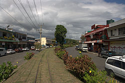
Sigatoka — is a town in Fiji. It is found on the island of Viti Levu and is situated at the mouth of the Sigatoka River, after which it is named, some 69 kilometers from Nadi. At the 1996 census, the last held, it had a population of 7940.An ornate mosque… … Wikipedia
Sigatoka — Sigatoka … Deutsch Wikipedia
sigatoka — sigatoka. f. Hond. Enfermedad de los bananos producida por dos hongos patógenos del orden de los Ascomicetos … Enciclopedia Universal
sigatoka — f. Hond. Enfermedad de los bananos producida por dos hongos patógenos del orden de los Ascomicetos … Diccionario de la lengua española
Sigatoka — /sig euh toh keuh/, n. Plant Pathol. a disease of bananas, characterized by discolored spots on the leaves, caused by a fungus, Mycosphaerella musicola. [after Sigatoka, river and district on the island of Viti Levu in the Fiji archipelago] * * * … Universalium
sigatoka — /sɪgəˈtoʊkə/ (say siguh tohkuh) noun a leaf spot disease of bananas caused by a sooty mould. {named after Sigatoka, district and river in Fiji} …
sigatoka — ˌsigəˈtōkə noun ( s) Etymology: from Sigatoka, district and river in the Fiji islands : a serious leaf spot disease of bananas occurring especially in tropical America and caused by a sooty mold (Cercospora musae) … Useful english dictionary
Sigatoka River — Der Sigatoka RiverVorlage:Infobox Fluss/KARTE fehlt DatenVorlage:Infobox Fluss/GKZ fehlt … Deutsch Wikipedia
Sigatoka Sand Dunes — The Sigatoka Sand Dunes National Park is located at the mouth of the Sigatoka River on the island of Viti Levu in Fiji. They are located approximately 3km West of the town of Sigatoka.They are the product of erosion in the coastal hinterland and… … Wikipedia
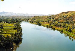
Sigatoka River — and flows for 120 kilometers to the coast between the central and western ranges. It is the chief means of transportation with some parts of the interior of the island. [cite book |last=Craigie |first=H. R. |authorlink= |coauthors= |title=… … Wikipedia


