- Région de Maranoa
-
Région de Maranoa 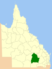
Localisation de la LGADonnées générales Pays  Australie
État ou Territoire Queensland Région Maranoa Superficie 58 830 km² Population 12 648 hab. (2006) Densité 0,21 hab./km² Administration Nom du Conseil Conseil de la région de Maranoa Siège du Conseil Roma Maire Robert Loughnan Site web http://www.romaregionalcouncil.qld.gov.au/ modifier 
La région de Maranoa est une zone d'administration locale au sud du Queensland en Australie.
Elle résulte de la fusion des comtés de Bendemere, Booringa, Bungil et Warroo avec la ville de Roma en mars 2008.
La région comprend les villes d'Injune, Mitchell, Roma, Surat et Yuleba et les villages et communautés d'Amby, Jackson, Muckadilla, Mungallala et Wallumbilla.
Elle est gérée par 8 conseillers et un maire sans découpage de circonscriptions.
Notes et références
Lien externe
Catégorie :- Zone d'administration locale du Queensland

Wikimedia Foundation. 2010.