Proboj

Proboj

43° 13′ 54″ N 17° 31′ 15″ E / 43.2317, 17.5208

Proboj
Administration
Pays Drapeau de Bosnie-Herzégovine Bosnie-Herzégovine
Entité Drapeau de la Fédération de Bosnie-et-Herzégovine Fédération de Bosnie-et-Herzégovine
Canton Herzégovine de l'ouest
Municipalité Ljubuški
Géographie
Coordonnées 43° 13′ 54″ Nord
       17° 31′ 15″ Est
/ 43.2317, 17.5208
Démographie
Population 769 hab. (1991)
Localisation
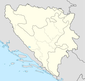
Bosnia and Herzegovina location map.svg
City locator 15.svg
Proboj

Proboj (en cyrillique : Пробој) est un village de Bosnie-Herzégovine. Il est situé dans la municipalité de Ljubuški et dans le canton de l'Herzégovine de l'ouest, Fédération de Bosnie-et-Herzégovine. Au recensement de 1991, il comptait 769 habitants, dont une majorité de Croates[1].

Sommaire

Démographie

Répartition de la population (1991)

Nationalité Nombre %
Croates 759 98,69
Yougoslaves 4 0,52
Serbes 1 0,13
Inconnus/autres 5 0,65[1]

Notes et références

  1. a et b (bs)(hr)(sr) Livre : Composition nationale de la population - Résultats de la République par municipalités et localités 1991, Bulletin statistique n°234, Publication de l'Institut national de statistique de Bosnie-Herzégovine, Sarajevo.

Voir aussi

Articles connexes

Liens externes


Wikimedia Foundation. 2010.

Contenu soumis à la licence CC-BY-SA. Source : Article Proboj de Wikipédia en français (auteurs)

Игры ⚽ Нужна курсовая?

Regardez d'autres dictionnaires:

  • proboj — próboj m DEFINICIJA 1. prodiranje kroz što, čin onoga koji se probija 2. vojn. prodor kroz neprijateljske redove, čin probijanja [izvršiti proboj] ETIMOLOGIJA vidi probiti …   Hrvatski jezični portal

  • próboj — m 1. {{001f}}prodiranje kroz što, čin onoga koji se probija 2. {{001f}}vojn. prodor kroz neprijateljske redove, čin probijanja [izvršiti ∼] …   Veliki rječnik hrvatskoga jezika

  • probòj — ôja m (ȍ ó) redko preboj: proboj stene / z mitraljezom kriti proboj; pasti pri proboju …   Slovar slovenskega knjižnega jezika

  • Rückersdorf (Gemeinde Sittersdorf) — Wappen Karte …   Deutsch Wikipedia

  • Sittersdorf — Žitara vas …   Deutsch Wikipedia

  • Ljubuški — 43° 11′ 49″ N 17° 32′ 42″ E / 43.1969, 17.5450 …   Wikipédia en Français

  • Liste der Gemeinden in Kärnten — Kärnten gliedert sich in 132 politisch selbstständige Gemeinden. Die Liste enthält alle Gemeindenamen und eingerückt die Katastralgemeinden (KG). Legende: Gemeindename nach Kommunalverwaltung Gemeindename in normaler Schrift: es gibt zusätzlich… …   Deutsch Wikipedia

  • Liste von Gemeinden in Kärnten — Kärnten gliedert sich in 132 politisch selbstständige Gemeinden. Die Liste enthält alle Gemeindenamen und eingerückt die Katastralgemeinden (KG). Legende: Gemeindename in normaler Schrift: es gibt zusätzlich eine Katastralgemeinde mit gleichem… …   Deutsch Wikipedia

  • Велики-Гложац — Координаты: 45°22′55″ с. ш. 15°09′43″ в. д. / 45.381944° с. ш. 15.161944° в. д.  …   Википедия

  • Völkermarkt (district) — The District of Völkermarkt is an administrative district in the Austrian State of Carinthia. MunicipalitiesVölkermarkt is divided into 13 municipalities, of which 2 are towns and 3 market towns.Towns*Bleiburg (Slov.: Pliberk ) (4,083) **Aich,… …   Wikipedia

Share the article and excerpts

Direct link
Do a right-click on the link above
and select “Copy Link”