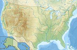
Peru Peak Wilderness
- Peru Peak Wilderness
-
L'aire sauvage Peru Peak Wilderness est une aire protégée située à l'intérieur de la forêt nationale des Montagnes Vertes, dans l'État du Vermont, aux États-Unis. Le nom provient du Peru Peak, qui est le plus haut sommet de l'aire protégée.
Notes et références
Annexes
Liens externes
Catégories :
- Aire protégée de l'UICN - catégorie Ib
- Aire protégée du Vermont
- Aire protégée créée en 1984
Wikimedia Foundation.
2010.
Contenu soumis à la licence CC-BY-SA. Source : Article Peru Peak Wilderness de Wikipédia en français (auteurs)
Regardez d'autres dictionnaires:
Appalachian Trail by state — The Appalachian National Scenic Trail spans fourteen U.S. states during its journey that is 2,179 miles (3,507 km) long, including Georgia, North Carolina, Tennessee, Virginia, West Virginia, Maryland, Pennsylvania, New Jersey, New York,… … Wikipedia
Wikiproyecto:Patrimonio de la Humanidad — Patrimonio de la Humanidad … Wikipedia Español
White Rocks National Recreation Area — Infobox protected area | name = White Rocks National Recreation Area iucn category = caption = locator x = 256 locator y = 45 location = Vermont, USA nearest city = Rutland, Vermont lat degrees = lat minutes = lat seconds = lat direction = long… … Wikipedia
Navel of the World — is a term which may refer to:* Easter Island, a location in the south Pacific Ocean * Omphalos, a Greek term for an ancient stone artifact * El Ombligo del Mundo , an earlier name of the Argentinian radio program La Venganza Será Terrible *… … Wikipedia
Forêt nationale de Green Mountain — Localisation Coordonnées 43° 57′ 0″ Nord … Wikipédia en Français
literature — /lit euhr euh cheuhr, choor , li treuh /, n. 1. writings in which expression and form, in connection with ideas of permanent and universal interest, are characteristic or essential features, as poetry, novels, history, biography, and essays. 2.… … Universalium
United States — a republic in the N Western Hemisphere comprising 48 conterminous states, the District of Columbia, and Alaska in North America, and Hawaii in the N Pacific. 267,954,767; conterminous United States, 3,022,387 sq. mi. (7,827,982 sq. km); with… … Universalium
Business and Industry Review — ▪ 1999 Introduction Overview Annual Average Rates of Growth of Manufacturing Output, 1980 97, Table Pattern of Output, 1994 97, Table Index Numbers of Production, Employment, and Productivity in Manufacturing Industries, Table (For Annual… … Universalium
Principal national parks of the world — ▪ Table Principal national parks of the world Africa Europe and Russia Asia North America and the Caribbean Australia and Oceania South America Africa country national park date area description protected status national park status square miles… … Universalium
performing arts — arts or skills that require public performance, as acting, singing, or dancing. [1945 50] * * * ▪ 2009 Introduction Music Classical. The last vestiges of the Cold War seemed to thaw for a moment on Feb. 26, 2008, when the unfamiliar strains … Universalium
 États-Unis
 Vermont


