Pedlinge
- Pedlinge
-
Pedlinge est un petit hameau en bordure du village de Saltwood dans le Kent . Il a sa propre église, même si elle est officiellement classé comme un district de la Chapel-of-Ease. Depuis Pedlinge fait partie de la paroisse de Saltwood , et non d'une paroisse à part entière.
Wikimedia Foundation.
2010.
Contenu soumis à la licence CC-BY-SA. Source : Article Pedlinge de Wikipédia en français (auteurs)
Regardez d'autres dictionnaires:
Pedlinge — infobox UK place country = England static static image caption=The church at Pedlinge, set amidst fields of sheep latitude= 51.077 longitude=1.055 official name=Pedlinge population = shire district= Shepway shire county = Kent region= South East… … Wikipedia
Saltwood — infobox UK place country = England latitude= 51.0806 longitude=1.0776 official name=Saltwood population = shire district= Shepway shire county = Kent region= South East England constituency westminster= Folkestone and Hythe post town= postcode… … Wikipedia
Romney, Hythe and Dymchurch Railway — Romney, Hythe Dymchurch Railway Northern Chief at New Romney Overview Type Light railway Locale Ken … Wikipedia
New Romney — For the former parliamentary borough, see New Romney (UK Parliament constituency). Coordinates: 50°59′06″N 0°56′28″E / 50.985°N 0.941°E / … Wikipedia
Dungeness (headland) — This article is about the headland in Kent, England. For the spit in Washington, United States, see Dungeness Spit. For the headland on the border of Chile and Argentina, see Punta Dúngeness. Coordinates: 50°55′00″N 0°58′00″E / … Wikipedia
Chapel of ease — A chapel of ease (sometimes chapel of ease ) is a church building other than the parish church, built within the bounds of a parish for the attendance of those who cannot reach the parish church conveniently. St Nicholas s Chapel in King s Lynn,… … Wikipedia
Dymchurch — Coordinates: 51°01′37″N 1°00′00″E / 51.027°N 1.00°E / 51.027; 1.00 … Wikipedia
Hawkinge — For the steamship, see SS Hawkinge. Coordinates: 51°07′01″N 1°09′50″E / 51.117°N 1.1638°E / 51.117; 1.1638 … Wikipedia
Cheriton, Kent — Coordinates: 51°05′17″N 1°08′31″E / 51.088°N 1.142°E / 51.088; 1.142 … Wikipedia
Westenhanger — Coordinates: 51°05′27″N 1°02′15″E / 51.0909°N 1.0375°E / 51.0909; 1.0375 … Wikipedia
 Angleterre
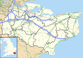
 Pedlinge