Paterson Inlet
- Paterson Inlet
-
46° 56′ 24″ S 168° 05′ 27″ E / -46.93995, 168.09081944
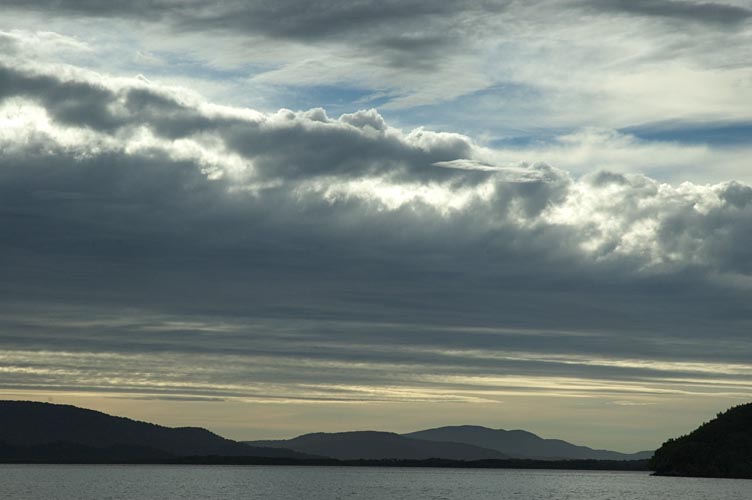
Patterson Inlet au coucher de soleil.
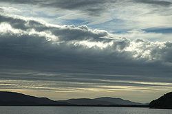
La vue depuis "Observation Point" donnant sur Paterson Inlet.
Paterson Inlet est un grand port naturel situé sur la côte est de l'Île Stewart, au sud de la Nouvelle-Zélande. L'unique ville de l'île, Oban, est située sur sa côte nord.
Plusieurs îles sont situées au coeur de Paterson Inlet, comme Ulva Island ou Native Island.
Wikimedia Foundation.
2010.
Contenu soumis à la licence CC-BY-SA. Source : Article Paterson Inlet de Wikipédia en français (auteurs)
Regardez d'autres dictionnaires:
Paterson Inlet — Kreuzfahrtschiff in der Paterson Bucht vom Observation Rock in Oban aus gesehen, im Vordergrund die Golden Bay 46.93995168.09081944444 Koordinaten … Deutsch Wikipedia
Paterson Inlet, New Zealand — DMS … Deutsch Wikipedia
Paterson Inlet, New Zealand — Paterson Inlet is a large natural harbour in the eastern coast of Stewart Island/Rakiura, New Zealand, much of which is unspoilt forest.This region was first inhabited by the Māori, who settled at a locale known as The Neck , which is a long… … Wikipedia
Paterson (disambiguation) — Paterson may refer to:PeoplePlaces*Paterson, New Jersey, USA *Paterson, New South Wales, Australia *Paterson, Washington, USA *Paterson River, New South Wales, Australia *Paterson Inlet, New Zealand *Division of Paterson, an electoral district in … Wikipedia
Paterson — Cette page d’homonymie répertorie les différents sujets et articles partageant un même nom. Paterson est un nom qui peut faire référence à : Sommaire 1 Homonymes 2 Toponymes … Wikipédia en Français
Corson's Inlet State Park — was established by the New Jersey Legislature in the early 1960s[1] to protect and preserve one of the last undeveloped tracts of land along the state’s oceanfront. The park borders Corson Inlet. The area’s natural habitats are teeming with… … Wikipedia
List of dual place names in New Zealand — The agreed dual name of Te Koko o Kupe / Cloudy Bay remembers both the Māori and British explorations of New Zealand. Many official place names in New Zealand are dual names, incorporating both the original Māori place names and the English names … Wikipedia
Stewart Island/Rakiura — Stewart Island/RakiuraTerritorial AuthorityNameStewart Island/RakiuraPopulation402 (2006)Land area1,746 km²Regional CouncilNameSouthland Stewart Island / Rakiura is the third largest island of New Zealand. It lies convert|30|km south of South… … Wikipedia
Isla de Baffin — (Baffin Island) Localización País … Wikipedia Español
Rakiura — Die Stewartinsel Die Stewartinsel (engl. Stewart Island, in der Sprache der Māori Rakiura) ist die drittgrößte Insel Neuseelands. Sie schließt sich 30 km südlich an die Neuseeländische Südinsel an. Ihre Fläche von 1746 km² entspricht etwa zwei… … Deutsch Wikipedia
 La vue depuis "Observation Point" donnant sur Paterson Inlet.
 Portail du monde maritime
 Portail de la Nouvelle-Zélande