Nannestad

Nannestad
Nannestad
Blason de Nannestad

Blason de Nannestad
Carte de Nannestad

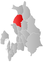
Localisation de Nannestad dans le Akershus
Administration
Pays Drapeau de Norvège Norvège
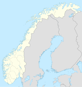
Région Østlandet
Comté Akershus
Centre administratrif Nannestad
Géographie
Coordonnées 60° 12′ 47″ Nord
       11° 30′ 00″ Est
/ 60.213, 11.5
Superficie 340,99 km²
Démographie
Population 10 657 hab. (2008)
Densité 31,25 hab./km²
Gentilé Nannestadsokning
Langue officielle Bokmål

  Géolocalisation sur la carte : Norvège

Norway location map.svg
Nannestad

Nannestad est une kommune de Norvège. Elle est située dans le comté d'Akershus.


Wikimedia Foundation. 2010.

Contenu soumis à la licence CC-BY-SA. Source : Article Nannestad de Wikipédia en français (auteurs)

Игры ⚽ Нужно решить контрольную?

Regardez d'autres dictionnaires:

  • Nannestad — kommune   Municipality   Coat of arms …   Wikipedia

  • Nannestad — Nannestad, Kirchspiel im norwegischen Amte Christiania …   Pierer's Universal-Lexikon

  • Nannestad — Wappen Karte …   Deutsch Wikipedia

  • Nannestad — Admin ASC 2 Code Orig. name Nannestad Country and Admin Code NO.01.0238 NO …   World countries Adminstrative division ASC I-II

  • Nannestad — Nes …   Danske encyklopædi

  • Коммуны Норвегии — Коммуны (норв. kommune, er …   Википедия

  • List of schools in Norway — Schools in Norway are usually divided into the following categories: elementary schools ( barneskole ) 1st to 7th grade, lower secondary schools ( ungdomsskole ) 8th to 10th grade, upper secondary schools ( videregående skole ) 11th to 13th grade …   Wikipedia

  • NO-02 — Wappen Karte Basisdaten Land: Norwegen …   Deutsch Wikipedia

  • Наннестад — норв. Nannestad   коммуна Норвегии   …   Википедия

  • List of municipalities of Norway — Norway This article is part of the series: Politics and government of Norway …   Wikipedia

Share the article and excerpts

Direct link
Do a right-click on the link above
and select “Copy Link”