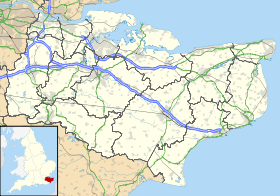
Marley (Kent)
- Marley (Kent)
-
Marley est un hameau éparpillés sur une petite route près d'un mile (1,6 km) à l'ouest de Barham .
Sur les autres projets Wikimedia :
Wikimedia Foundation.
2010.
Contenu soumis à la licence CC-BY-SA. Source : Article Marley (Kent) de Wikipédia en français (auteurs)
Regardez d'autres dictionnaires:
Marley, Maidstone — Marley is a hamlet in the civil parish of Harrietsham that, in turn, forms part of the district of Maidstone in the English county of Kent. External links Map sources for Marley, Maidstone … Wikipedia
Marley, Barham, Kent — Marley near Barham, Kent is a scattered hamlet on a minor road about one mile (1.6km) to the west of Barham. Coordinates: 51°12′33″N 1°07′46″E / 51.2092°N … Wikipedia
Kent Life — (Formerly the Museum of Kent Life.) is an open air museum located at Sandling, next to Allington Locks on the east bank of the River Medway. Contents 1 History 2 Farming 3 Buildings … Wikipedia
Marley, Deal — For other places with the same name, see Marley (disambiguation). Coordinates: 51°14′00″N 1°20′28″E / 51.2333°N 1.3412°E / 51.2333; 1.3412 … Wikipedia
Marley — This long established surname is of Anglo Saxon origin, and is locational from any of the various places thus called, including Marley in Devonshire, Durham, Kent and the West Riding of Yorkshire, or Marley Farm in Brede (Sussex). The Yorkshire… … Surnames reference
Sandwich, Kent — Coordinates: 51°16′29″N 1°20′20″E / 51.27472°N 1.33889°E / 51.27472; 1.33889 For other uses, see Sandwich (di … Wikipedia
Deal, Kent — Coordinates: 51°13′21″N 1°24′02″E / 51.2226°N 1.4006°E / 51.2226; 1.4006 … Wikipedia
Marden, Kent — Coordinates: 51°10′28″N 0°29′39″E / 51.174477°N 0.494198°E / 51.174477; 0.494198 … Wikipedia
Maxton, Kent — Coordinates: 51°07′13″N 1°17′20″E / 51.1204°N 1.2889°E / 51.1204; 1.2889 … Wikipedia
Martin, Kent — For other places with the same name, see Martin (disambiguation). Coordinates: 51°10′44″N 1°20′22″E / 51.1790°N 1.3394°E / 51.1790; 1.3394 … Wikipedia
 Angleterre
