Knežina

Knežina

44° 01′ 12″ N 18° 45′ 32″ E / 44.0200, 18.7589

Knežina
Кнежина
Administration
Pays Drapeau de Bosnie-Herzégovine Bosnie-Herzégovine
Entité Drapeau de la république serbe de Bosnie République serbe de Bosnie
Municipalité Sokolac
Géographie
Coordonnées 44° 01′ 12″ Nord
       18° 45′ 32″ Est
/ 44.0200, 18.7589
Démographie
Population 465 hab. (1991)
Localisation
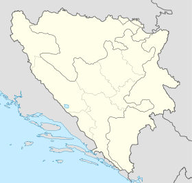
Bosnia and Herzegovina location map.svg
City locator 15.svg
Knežina

Knežina (en serbe cyrillique : Кнежина) est un village de Bosnie-Herzégovine. Il est situé dans la municipalité de Sokolac, République serbe de Bosnie. Au recensement de 1991, il comptait 465 habitants, dont une majorité de Musulmans (Bosniaques)[1].

Sommaire

Démographie

Répartition de la population (1991)

Nationalité Nombre %
Musulmans 289 62,15
Serbes 170 36,56
Yougoslaves 5 1,08
Inconnus/autres 1 0,21[1]

En 1991, la communauté locale de Knežina comptait 2 282 habitants, répartis de la manière suivante[2] :

Nationalité Nombre %
Musulmans 1 665 72,96
Serbes 600 26,29
Yougoslaves 12 0,53
Croates 1 0,04
Inconnus/autres 4 0,18

Notes et références

  1. a et b (bs)(hr)(sr) Livre : Composition nationale de la population - Résultats de la République par municipalités et localités 1991, Bulletin statistique n°234, Publication de l'Institut national de statistique de Bosnie-Herzégovine, Sarajevo.
  2. (bs)(hr)(sr)[PDF] Recensement par communautés locales sur http://www.fzs.ba, Bosnie-Herzégovine - Fédération de Bosnie-et-Herzégovine - Institut fédéral de statistique. Consulté le 11 octobre 2010

Voir aussi

Articles connexes

Liens externes


Wikimedia Foundation. 2010.

Contenu soumis à la licence CC-BY-SA. Source : Article Knežina de Wikipédia en français (auteurs)

Игры ⚽ Нужно сделать НИР?

Regardez d'autres dictionnaires:

  • Mačva — Macso redirects here. For the Romanian village of Măceu, called Mácsó in Hungarian, see Bretea Română. Map of the Mačva region Mačva (Serbian Cyrillic: Мачва, pronounced [mâːt͡ʃv̞a]) is a geographical region in Serbia, mostly situated in the …   Wikipedia

  • Sokolac — Соколац …   Deutsch Wikipedia

  • Mačva (région) — Pour les articles homonymes, voir Mačva. Carte de la région de Mačva …   Wikipédia en Français

  • Sokolac (République serbe de Bosnie) — Pour les articles homonymes, voir Sokolac. 43° 56′ 23″ N 18° 48′ 06″ E …   Wikipédia en Français

  • Hilandar — Хиландар Monastery information Full Name Хиландар Order Serbian Orthodox …   Wikipedia

  • Stefan Nemanja — Стѣфань Неманя Стефан Немања Grand Prince of Rascia The fresco of Saint Simeon (Stefan Nemanja), King s Church in Studenica monastery Gran …   Wikipedia

  • Serbian Orthodox Church — Српска православна црква Srpska pravoslavna crkva Cathe …   Wikipedia

  • Devič — For other uses, see Devic (disambiguation). Devič Monastery Devič Monastery reconstruction after it was burned down in 2004 Monastery information Full Name Манастир Девич …   Wikipedia

  • Our Lady of Ljeviš — Medieval Monuments in Kosovo * UNESCO World Heritage Site Country …   Wikipedia

  • Ostrog monastery — Monastery of Ostrog. Monastery information Full Name Манастир Острог Order Serbian Orthodox …   Wikipedia

Share the article and excerpts

Direct link
Do a right-click on the link above
and select “Copy Link”