Kiwayu
- Kiwayu
-
Kiwayu (aussi Kiwayuu ou Kiwaihu) est une petite île de l'océan Indien, appartenant au Kenya et située dans l’est de l'archipel de Lamu dans la réserve naturelle maritime de Kiunga. Elle se situe à 10 km environ au nord de l’île de Pate. Une colline conique d’une hauteur de 47 m se trouve au centre de l’île[1].
Les ressources de l’île sont la pêche et le tourisme. L’île dispose d‘une école et d’un puits. L’hôpital le plus proche est celui de l’île de Lamu distante de 2 heures en bateau à moteur (ou 7 heures en boutre).
Références
Liens externes
Wikimedia Foundation.
2010.
Contenu soumis à la licence CC-BY-SA. Source : Article Kiwayu de Wikipédia en français (auteurs)
Regardez d'autres dictionnaires:
Kiwayu — Vorlage:Infobox Insel/Wartung/Fläche fehlt Kiwayu Westseite der Insel Gewässer Indischer Ozean … Deutsch Wikipedia
Kiwayu — Kiwayuu (alternate spelling Kiwayu) is a small island in the eastern part of the Lamu Archipelago, situated in the Kiunga Marine National Reserve. The main economic activity is fishing, and there is one school, no clinic and one well on the… … Wikipedia
Kiwayu Airport — is an airport in Kiwayu, Kenya airport codes|KWY|N/A.cheduled Services*Airkenya (Lamu)References* [http://www.farecompare.com/flights/Kiwayu KWY/city.html Kiwayu Destinations] … Wikipedia
Isla Kiwayuu — Kiwayuu / Kiwayu La parte oriental de la isla Localización País … Wikipedia Español
Liste der Flughäfen in Kenia — Die Liste der Flughäfen in Kenia führt zivile und militärische Flughäfen im ostafrikanischen Staat Kenia geordnet nach Ort auf. Inhaltsverzeichnis 1 Quellen 2 Weblinks Ort ICAO Code … Deutsch Wikipedia
Wilson Airport (Kenya) — Infobox Airport name = Wilson Airport nativename = nativename a = nativename r = image width = caption = IATA = WIL ICAO = HKNW type = Public owner = operator = Kenya Airports Authority city served = location = Nairobi elevation f = 5,536… … Wikipedia
Regional Air — was an airline based in Nairobi, Kenya. It was Airkenya s jet operation providing scheduled services. It was based at Jomo Kenyatta International Airport, Nairobi Flight International 12 18 April 2005] . It suspended operations in 2005. Fact|date … Wikipedia
Lamu Archipelago — The Lamu Archipelago is located in the Indian Ocean close to the northern coast of Kenya, to which it belongs. The islands lie between the towns of Lame and Kiunga, close to the border with Somalia, and is a part of Lamu District.The largest of… … Wikipedia
Manda Island — Lamu Archipelago Map of Kenya showing the islands Lamu Island Lamu Town †• Shela Matondoni Kipangani Manda Island … Wikipedia
Fly540 — Infobox Airline airline = Fly540 logo size = 50 fleet size = 5 destinations = 7 IATA = 5H ICAO = FFV callsign = SWIFT TANGO parent = company slogan = Simplifly founded = 2006 headquarters = key people = Neil Steffen, Don Smith (Chief Exectutive… … Wikipedia
 Kenya
Kenya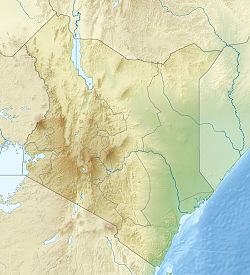
 Kiwayu