Itamari

Itamari
Itamari
Administration
Pays Drapeau : Brésil Brésil
Région Nord-Est
État Bahia Bahia
Maire Waldson Carlos Andrade Menezes (PT)
Démographie
Population 8 781 hab. (IBGE 2009)
Densité 67 hab./km²
Géographie
Coordonnées 13° 47′ 00″ S 39° 37′ 00″ W / -13.783333, -39.61666713° 47′ 00″ Sud
       39° 37′ 00″ Ouest
/ -13.783333, -39.616667
  
Superficie 131,469 km2
Informations
Fuseau horaire UTC-3
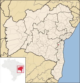
Localisation de Itamari
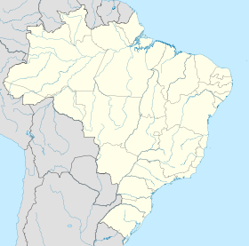
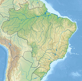
Localisation de Itamari sur une carte
Voir la carte administrative
City locator 14.svg
Voir la carte topographique
City locator 14.svg

Itamari est une municipalité de l'État de Bahia au Brésil.

Sa population était estimée à 8 781 habitants en 2009 et elle s'étend sur 131,469 km².

Elle appartient à la Microrégion d'Ilhéus-Itabuna dans la Mésorégion du Sud de Bahia.

État de Bahia, Nordeste
Portal.svg Portail — Géographie, Histoire, Sport
Bahia, Brésil Drapeau de Bahia Drapeau du Brésil
Capitale Salvador
Mésorégions Centre-Nord de Bahia | Centre-Sud de Bahia | Extrême Ouest de Bahia | Métropolitaine de Salvador | Nord-Est de Bahia | Sud de Bahia | Vallée du São Francisco de Bahia
Microrégions Alagoinhas | Barra | Barreiras | Bom Jesus da Lapa | Boquira | Brumado | Catu | Cotegipe | Entre Rios | Euclides da Cunha | Feira de Santana | Guanambi | Ilhéus-Itabuna | Irecê | Itaberaba | Itapetinga | Jacobina | Jequié | Jeremoabo | Juazeiro | Livramento do Brumado | Paulo Afonso | Porto Seguro | Ribeira do Pombal | Salvador | Santa Maria da Vitória | Santo Antônio de Jesus | Seabra | Senhor do Bonfim | Serrinha | Valença | Vitória da Conquista
Région métropolitaine Salvador
Plus de 100 000 habitants Alagoinhas | Barreiras | Camaçari | Feira de Santana | Ilhéus | Itabuna | Jequié | Juazeiro | Lauro de Freitas | Paulo Afonso | Porto Seguro | Salvador | Vitória da Conquista | Teixeira de Freitas

Wikimedia Foundation. 2010.

Contenu soumis à la licence CC-BY-SA. Source : Article Itamari de Wikipédia en français (auteurs)

Игры ⚽ Поможем написать реферат

Regardez d'autres dictionnaires:

  • Itamari — Admin ASC 2 Code Orig. name Itamari Country and Admin Code BR.05.2915700 BR …   World countries Adminstrative division ASC I-II

  • Итамари — Муниципалитет Итамари Itamari Страна БразилияБразилия …   Википедия

  • KABBALAH — This entry is arranged according to the following outline: introduction general notes terms used for kabbalah the historical development of the kabbalah the early beginnings of mysticism and esotericism apocalyptic esotericism and merkabah… …   Encyclopedia of Judaism

  • Муниципалитеты штата Баия — …   Википедия

  • Mirante — is a municipality/county in the state of Bahia in Brazil. In 2004 it had a population of 16,476. See also Mirante do Paranapanema, in São Paulo v …   Wikipedia

  • Cruz das Almas — is a small city near Salvador, in the state of Bahia, in Brazil. In 2004, it had an estimated population of 56.000 inhabitants. Its climate is tropical, hot and humid. The economy is based on agriculture, especially tobacco, orange and cassava… …   Wikipedia

  • Morro do Chapéu — is a small city in the Brazilian state of Bahia, 386 km northwest of its capital, Salvador, 1012 meters above the sea level, because of which it is one of the coolest towns in Bahia, with temperatures occasionally falling below 10 °C in the… …   Wikipedia

  • Correntina — is a town in the state of Bahia in Brazil, 500 km from Brasilia and 980 km from Salvador. History Correntina was first mentioned in the dispatches of the Entradistas and Bandereirantes who visited the city in 1700 and 1790. The Decree… …   Wikipedia

  • Mucuri — Curaçá   Municipality   The Municipality of Curaçá Costa Dourada beach and its cliffs: the first beach in Bahia from so …   Wikipedia

  • Conceição do Almeida — Location of Conceição do Almeida Coordinates …   Wikipedia

Share the article and excerpts

Direct link
Do a right-click on the link above
and select “Copy Link”