Hotham River
- Hotham River
-
32°58′S 116°22′E / -32.967, 116.367
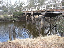
L'Hotham River au pont de Pumphreys, entre
Narrogin et Wandering.
L’Hotham est une rivière et l'un des principaux affluents du Murray en Australie-Occidentale. Elle atteint environ 160km de long avec sa portion amont, la Hotham River North, qui prend sa source dans la chaine Dutarning et devient la Hotham lors de son passage sous la Great Southern Highway près de Popanyinning. Un affluent long de 15 km, la Hotham River South, nait près de Cuballing et coule vers le nord avant de rejoindre la Hotham près de Yornaning.
À partir de Narrogin, la rivière coule en direction nord à travers la région de Cuballing et le Dryandra Woodland avant de se diriger vers l'ouest vers Wandering et Boddington.
Elle rejoint la Williams près du mont Saddleback pour former le Murray.
Historique
Le cours d'eau a été découvert par Thomas Bannister en 1830 et a été probablement nommé par le gouverneur James Stirling, du nom de l'amiral Sir Henry Hotham.
Catégorie :
- Cours d'eau d'Australie-Occidentale
Wikimedia Foundation.
2010.
Contenu soumis à la licence CC-BY-SA. Source : Article Hotham River de Wikipédia en français (auteurs)
Regardez d'autres dictionnaires:
Hotham River — Pumphreys Bridge über den Hotham River auf halben Wege zwischen Narrogin und Wandering … Deutsch Wikipedia
Hotham River — The Hotham River is one of the major tributaries of the Murray River in Western Australia. It is about 160km long in total with its upper reaches being the Hotham River North, which begins in the Dutarning Range and joins the Hotham at its… … Wikipedia
Hotham Inlet — is an arm of Kotzebue Sound on the northwestern coast of the U.S. state of Alaska. It is 50 miles (80 km) long and 5–20 miles (8–32 km) wide. The inlet is the outlet of the Kobuk and Selawik Rivers and it is bounded on the SW by the Baldwin… … Wikipedia
Murray River (Western Australia) — Murray River Brücke über den Murray River in Pinjarra (ca. 1900–1910)Vorlage:Infobox Fluss/KARTE fehlt … Deutsch Wikipedia
Bannister River — Bannister RiverVorlage:Infobox Fluss/GKZ fehlt Lage Wheatbelt Region, Westaustralien Flusssystem Murray River (Western Australia) Abfluss über Hotham River … Deutsch Wikipedia
Crossman River — Crossman RiverVorlage:Infobox Fluss/GKZ fehlt Lage Wheatbelt Region, Westaustralien Flusssystem Murray River (Western Australia) Abfluss über Hotham River … Deutsch Wikipedia
Williams River (Western Australia) — Williams River Williams RiverVorlage:Infobox Fluss/KARTE fehlt DatenVorlage:Infobox Fluss/GKZ fehlt … Deutsch Wikipedia
Murray River (Western Australia) — Murray River Pinjarra Bridge over the Murray River. ca 1900 1910 Origin Mount Keats Mouth Peel Harvey Estuary … Wikipedia
Williams River (Western Australia) — The Williams River is one of the major tributaries of the Murray River in Western Australia.It starts between Williams and Narrogin and flows in a general westerly direction before it joins the Hotham River to become the Murray River near Mount… … Wikipedia
Kobuk River — The Kobuk River is approximately convert|280|mi|km|0|lk=on long, located in the Arctic region of northwestern Alaska in the United States. [USGS Geographic Names Information System (GNIS). [http://geonames.usgs.gov/pls/gnispublic/f?p=gnispq:3:::NO… … Wikipedia

