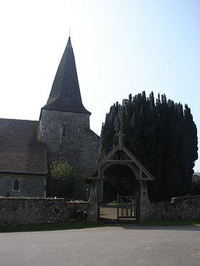
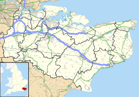
Hinxhill
Contenu soumis à la licence CC-BY-SA. Source : Article Hinxhill de Wikipédia en français (auteurs)
Regardez d'autres dictionnaires:
Hinxhill — infobox UK place country = England official name= Hinxhill latitude= 51.1449 longitude= 0.9304 population = 2,384 (Parish) civil parish= Wye with Hinxhill shire district= Ashford shire county= Kent region= South East England constituency… … Wikipedia
Wye with Hinxhill — infobox UK place country = England official name= Wye with Hinxhill latitude= 51.1815longitude= 0.9413population = 2,384 [ [https://secure.ashford.gov.uk/pages/liv wrk/liv wrk fig dem.jsp Ashford Borough Council] Census 2001] civil parish= Wye… … Wikipedia
Wye with Hinxhill — 51° 10′ 53″ N 0° 56′ 29″ E / 51.1815, 0.9413 Wye with Hinxhill est une … Wikipédia en Français
Wye, Kent — infobox UK place country = England official name= Wye static static image caption=Wye parish church latitude= 51.1815 longitude= 0.9413 population = 2,384 (Parish) [ [http://www.ashford.gov.uk/about the borough/towns and villages/wye.aspx Ashford … Wikipedia
A. J. Arkell — Infobox Scientist name = A. J. Arkell birth date = July 29 1898 birth place = Hinxhill, Kent, England death date = February 26 1980 death place = Chelmsford residence = citizenship = nationality = British ethnicity = field = archaeology work… … Wikipedia
List of Grade I listed buildings in Kent — There are over 6000 Grade I listed buildings in England. This page is a list of these buildings in the county of Kent.Ashford* Church of St Martin, Aldington * Church of SS Peter Paul, Appledore * Church of St Margaret, Bethersden * 3 High St,… … Wikipedia
Chute Baronets — The Vyne, the seat of the Chute family. There have been two Baronetcies created for persons with the surname Chute, one in the Baronetage of England and one in the Baronetage of the United Kingdom. Both creations are extinct. The Chute Baronetcy … Wikipedia
Charing — See also Charing Cross, Charing, Tibet, and Charing (painting) Coordinates: 51°12′39″N 0°47′42″E / 51.2107°N 0.7949°E / … Wikipedia
Chilham — Coordinates: 51°14′35″N 0°57′35″E / 51.2431°N 0.9596°E / 51.2431; 0.9596 … Wikipedia
Mersham — Coordinates: 51°07′07″N 0°56′04″E / 51.1187°N 0.9345°E / 51.1187; 0.9345 … Wikipedia
 Église de Hinxhill
 Angleterre
