Győrszemere
- Győrszemere
-
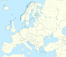
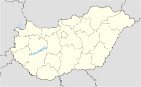
Győrszemere est un village et une commune du comitat de Győr-Moson-Sopron en Hongrie.
Géographie
Cette section est vide, insuffisamment détaillée ou incomplète.
Votre aide est la bienvenue !
Histoire
Cette section est vide, insuffisamment détaillée ou incomplète.
Votre aide est la bienvenue !
Catégorie :
- Ville et village du comitat de Győr-Moson-Sopron
Wikimedia Foundation.
2010.
Contenu soumis à la licence CC-BY-SA. Source : Article Győrszemere de Wikipédia en français (auteurs)
Regardez d'autres dictionnaires:
Győrszemere — Infobox Settlement subdivision type = Country subdivision name = HUN timezone=CET utc offset=+1 timezone DST=CEST utc offset DST=+2|official name=Győrszemere subdivision type1=County subdivision name1=Győr Moson Sopron area total km2=33.11… … Wikipedia
Gyorszemere — Original name in latin Gyrszemere Name in other language Gyorszemere, Gyrszemere State code HU Continent/City Europe/Budapest longitude 47.55256 latitude 17.56356 altitude 127 Population 2964 Date 2012 05 06 … Cities with a population over 1000 database
Győrszemere — Sp Dėrsemerė Ap Győrszemere L Vengrija … Pasaulio vietovardžiai. Internetinė duomenų bazė
Kleingebiet Tét — Das Kleingebiet Tét (ungarisch Téti kistérség) ist eine ungarische Verwaltungseinheit (LAU 1) innerhalb des Komitats Győr Moson Sopron. Der Verwaltungssitz ist in Tét. Gemeinden Árpás Bodonhely Csikvánd Egyed Felpéc Gyarmat Gyömöre Győrszemere… … Deutsch Wikipedia
Sopron — This article is about the city. For the historical county in the Kingdom of Hungary named Sopron / Ödenburg, see Sopron (county). Sopron Aerial photography of the City Hall and the Main square … Wikipedia
Dalton Plan — The Dalton Plan is an educational concept created by Helen Parkhurst. Inspired by the intellectual ferment at the turn of the 19th century, educational thinkers such as Maria Montessori and John Dewey began to cast a bold vision of a new… … Wikipedia
Győr-Moson-Sopron County — Infobox Hungarian county name =Győr Moson Sopron region =Western Transdanubia seat = Győr area = 4089 population = 420,000 density = 103 cities = 174Győr Moson Sopron is the name of an administrative county (comitatus or megye) in north western… … Wikipedia
Mosonmagyaróvár — Wieselburg Ungarisch Altenburg Castle … Wikipedia
Csorna — Aerial view … Wikipedia
Kleingebiet Tet — Koordinaten fehlen! Hilf mit. Das Kleingebiet Tét (ungarisch Téti kistérség) ist eine ungarische Verwaltungseinheit (LAU 1) innerhalb des Komitats Győr Moson Sopron. Der Verwaltungssitz ist in Tét. Gemeinden Árpás Bodonhely Csikvánd Egyed Felpéc… … Deutsch Wikipedia

 Hongrie


