Great Captain Island
- Great Captain Island
-
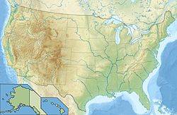
Great Captain Island est une île située au large de la ville de Greenwich, au Connecticut, et abrite le phare datant du XIXe siècle Great Captain Island Light.
L'île fait partie d'un groupe de trois îles. Elle est nommée d'après le Capitaine Daniel Patrick, l'un des premiers colons de Greenwich[1].
Les Aigrettes, hérons, Balbuzars pêcheurs, et autres oiseaux peuvent être observés sur l'île.
Notes et références
- ↑ [1]"Great Captain Island, CT" page de LighthouseFriends.com, 21 août 2006
Catégories :
- Île des États-Unis
- Géographie du Connecticut
Wikimedia Foundation.
2010.
Contenu soumis à la licence CC-BY-SA. Source : Article Great Captain Island de Wikipédia en français (auteurs)
Regardez d'autres dictionnaires:
Great Captain Island — Infobox Islands name = Great Captain image caption = Great Captain Island Light, from a postcard (c. 1907 1914) image size = locator Location map|Connecticut|lat=40.9825|long= 73.6235 map custom = yes native name = native name link = nickname =… … Wikipedia
Great Captain Island Light — Infobox Lighthouse caption = The light in 1935 (U.S. Coast Guard photo) location = Greenwich, Connecticut coordinates = coord|40.9825|N|73.6235|W|name=Great Captain Island Light|display=inline,title|type:landmark region:US yearbuilt = 1830… … Wikipedia
Phare de Great Captain Island — Le phare en 1935 Coordonnées … Wikipédia en Français
Great Barrier Island — Aotea (Māori) Nickname: The Barrier Kaitoke Beach in the east of Great Barrier Island. The White Cliffs can be seen in the front right … Wikipedia
Great Barrier Island — ▪ island, New Zealand island marking the northeastern corner of Hauraki Gulf, eastern North Island, New Zealand. Separated from the Coromandel Peninsula (south) by Colville Channel, it is the largest island off North Island, with a total… … Universalium
Great Keppel Island — Infobox Australian Place | type = town name = Great Keppel Island state = qld caption = Shelving Beach on Great Keppel Island lga = postcode = pop = timezone = UTC+10 elevation= maxtemp = mintemp = rainfall = stategov = fedgov = dist1 = 15… … Wikipedia
Captain Jat — is a fictional sea captain created by English writer William Hope Hodgson. Captain Jat was another attempt to create a recurring character, like Hodgson s Captain Gault. Captain Jat is featured in the stories The Island of the Ud and The… … Wikipedia
Captain Eo — Localisation Parc : EPCOT Zone : Future World Lieu : Orlando (Floride) … Wikipédia en Français
Captain Nemo — is a fictional character featured in Jules Verne s novels Twenty Thousand Leagues Under the Sea (1870) and The Mysterious Island (1874). Nemo is Latin for no one , and also Greek for give what is due (see Nemesis). Nemo, one of the most famous… … Wikipedia
Sheffield Island Light — Infobox nrhp name = Sheffield Island Light nrhp type = caption = location = Norwalk, Connecticut lat degrees = 41 lat minutes = 2 lat seconds = 55.61 lat direction = N long degrees = 73 long minutes = 25 long seconds = 8.93 long direction = W… … Wikipedia
 États-Unis
 États-Unis
 Connecticut
