Goomeri
- Goomeri
-
Goomeri est une localité située dans la partie sud-est de l'État du Queensland, en Australie, à environ 235 kilomètres au nord-ouest de la capitale de l'état, Brisbane. Elle est située à l'intersection de la Burnett Highway avec les Bunya et Wide Bay Highways. Elle compte 488 habitants
Le nom Goomeri est d'origine aborigène et signifierait bouclier brisé.
Références
Sur les autres projets Wikimedia :
Wikimedia Foundation.
2010.
Contenu soumis à la licence CC-BY-SA. Source : Article Goomeri de Wikipédia en français (auteurs)
Regardez d'autres dictionnaires:
Goomeri, Queensland — Infobox Australian Place | type = town name = Goomeri state = qld caption = lga = Gympie Regional Council postcode = 4601 est = 1911 pop = 488 pop footnotes = elevation= maxtemp = mintemp = rainfall = stategov = Callide fedgov = Wide Bay dist1 =… … Wikipedia
Nanango railway line — Nanango Branch Railway, Queensland, Australia. On 31 October 1882, parliament approved the construction of a branch line from Theebine (then called Kilkivan Junction) west to Kilkivan after gold and copper were discovered in this region of… … Wikipedia
Wide Bay Highway — La Wide Bay Highway est une route située dans l État du Queensland, en Australie. C est une route relativement courte, d environ 45 kilomètres, de direction est ouest reliant Goomeri à Gympie. La route relie la Burnett Highway à la Bruce Highway … Wikipédia en Français
Bunya Highway — Infobox Australian Road road name = Bunya Highway route route route photo = caption = length = 173 direction = North South start = finish = est = through = Murgon, Wondai, Kingaroy, Kumbia, Bell route = exits = The Bunya Highway is a 173… … Wikipedia
Wide Bay Highway — Infobox Australian Road road name = Wide Bay Highway route route route photo = caption = length = 45 direction = West East start = finish = est = through = Kilkivan route = exits = The Wide Bay Highway is a state highway of Queensland, Australia … Wikipedia
Bunya Highway — La Bunya Highway ( ) est une route longue de 173 km située dans l État du Queensland, en Australie. C est une route relativement courte, de direction nord est sud ouest allant de Goomeri à Dalby. La route relie la Warrego Highway à la Burnett… … Wikipédia en Français
Burnett Highway — Infobox Australian Road road name = Burnett Highway route route route photo = caption = Formerly length = 553 direction = North South start = finish = est = through = Mt. Morgan, Biloela, Monto, Gayndah, Goomeri route = Biloela West Biloela: )… … Wikipedia
Shire of Kilkivan — Infobox Australian Place | type = lga name = Shire of Kilkivan state = qld imagesize= 135 caption = Location within Queensland area = 3263.4 est = 1886 seat = Kilkivan pop = 3,431 pop footnotes = (2006 census) [Census 2006 AUS | id = LGA34300 |… … Wikipedia
Mundubbera, Queensland — Infobox Australian Place | type = town name = Mundubbera state = qld caption = lga = North Burnett Regional Council postcode = 4626 pop = 1,053 pop footnotes = est = elevation= maxtemp = mintemp = rainfall = stategov = Callide fedgov = Flynn… … Wikipedia
Rail transport in Queensland — has a long history, with the first line opening in 1865. Today it is the second largest narrow gauge railway network in the world.The first line was surveyed while the colony was still part of New South Wales, but the colony of Queensland had… … Wikipedia
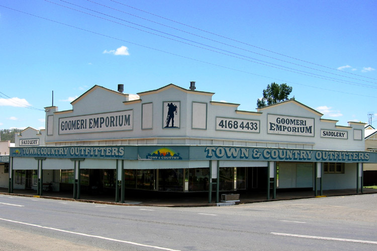
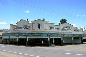 Le Goomeri Emporium
 Australie
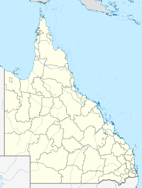
 Goomeri