Dobrošin

Dobrošin
Page d'aide sur l'homonymie Pour les articles homonymes, voir Dobrosin.

43° 53′ 56″ N 17° 38′ 23″ E / 43.8989, 17.6397

Dobrošin
Administration
Pays Drapeau de Bosnie-Herzégovine Bosnie-Herzégovine
Entité Drapeau de la Fédération de Bosnie-et-Herzégovine Fédération de Bosnie-et-Herzégovine
Canton Bosnie centrale
Municipalité Gornji Vakuf-Uskoplje
Géographie
Coordonnées 43° 53′ 56″ Nord
       17° 38′ 23″ Est
/ 43.8989, 17.6397
Démographie
Population 546 hab. (1991)
Localisation
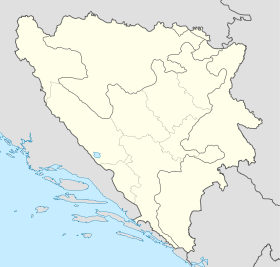
Bosnia and Herzegovina location map.svg
City locator 15.svg
Dobrošin

Dobrošin (en cyrillique : Доброшин) est un village de Bosnie-Herzégovine. Il est situé dans la municipalité de Gornji Vakuf-Uskoplje et dans le canton de Bosnie centrale, Fédération de Bosnie-et-Herzégovine. Au recensement de 1991, il comptait 546 habitants, dont une majorité de Croates[1].

Sommaire

Démographie

Répartition de la population (1991)

Nationalité Nombre %
Croates 545 99,81
Serbes 1 0,18[1]

En 1991, la communauté locale de Dobrošin comptait 960 habitants, répartis de la manière suivante[2] :

Nationalité Nombre %
Croates 562 58,54
Musulmans 396 41,25
Serbes 1 0,10
Inconnus/autres 1 0,10

Notes et références

  1. a et b (bs)(hr)(sr) Livre : Composition nationale de la population - Résultats de la République par municipalités et localités 1991, Bulletin statistique n°234, Publication de l'Institut national de statistique de Bosnie-Herzégovine, Sarajevo.
  2. (bs)(hr)(sr)[PDF] Recensement par communautés locales sur http://www.fzs.ba, Bosnie-Herzégovine - Fédération de Bosnie-et-Herzégovine - Institut fédéral de statistique. Consulté le 11 octobre 2010

Voir aussi

Articles connexes

Liens externes


Wikimedia Foundation. 2010.

Contenu soumis à la licence CC-BY-SA. Source : Article Dobrošin de Wikipédia en français (auteurs)

Игры ⚽ Поможем написать реферат

Regardez d'autres dictionnaires:

  • Dobrosin —   Village   Country Serbia District Pčinja District Municipality Bujanovac Population (20 …   Wikipedia

  • Dobrošin —   Village   Country  Bosnia and Herzegovina Municipality …   Wikipedia

  • Dobrosin —  Pour l’article homonyme, voir Dobrošin.  Dobrosin Добросин, Dobrosini Administration …   Wikipédia en Français

  • Bujanovac — Бујановац La gare routière de Bujavovac Administration …   Wikipédia en Français

  • Gornji Vakuf-Uskoplje — 43° 56′ 17″ N 17° 35′ 18″ E / 43.9381, 17.5883 …   Wikipédia en Français

  • UCPMB — The Liberation Army of Preševo, Medveđa and Bujanovac (Albanian: Ushtria Çlirimtare e Preshevës, Medvegjës dhe Bujanocit , UCPMB) was a guerrilla group fighting for independence from Serbia (then Yugoslavia) for the three municipalities: Preševo …   Wikipedia

  • Bujanovac — Infobox Serbia municipality native name = Бујановац|official name=Bujanovac image shield = district = Pčinja mayor = Nagip Arifi area km2 = 461 population total = 12011 | mpop=43302 latd = 42| latm = 28|longd = 21| longm = 46 code = 17… …   Wikipedia

  • Gornji Vakuf-Uskoplje — Горњи Вакуф Ускопље   Municipality and town   …   Wikipedia

  • Insurgency in the Preševo Valley — Warbox conflict=Insurgency in the Preševo Valley partof=Yugoslav Wars campaign= colour scheme=background:#bbcccc caption=Serbian special police forces in the village of Oraovica near southern Serbian town of Preševo date=1999 2001 place=Preševo,… …   Wikipedia

  • List of cities, towns and villages in Serbia — This is the complete list of settlements in Serbia without Kosovo, as recorded by 2002 census, sorted by municipalities. Settlements denoted as urban (towns and cities) are marked bold. Population for every settlement is given in brackets. The… …   Wikipedia

Share the article and excerpts

Direct link
Do a right-click on the link above
and select “Copy Link”