- District de Loxton Waikerie
-
District de Loxton Waikerie 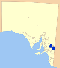
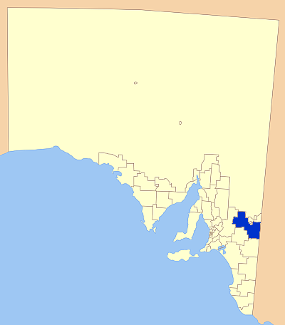
Localisation de la LGADonnées générales Pays  Australie
État ou Territoire Australie-Méridionale Superficie 7 957 km² Population 11 604 hab. (2006) Densité 1,5 hab./km² Administration Nom du Conseil Conseil du district de Loxton Waikerie Siège du Conseil Loxton Maire Dean Maywald Site web http://www.loxtonwaikerie.sa.gov.au/site/page.cfm modifier 
Le district de Loxton Waikerie (District of Loxton Waikerie) est une zone d'administration locale située à l'est de l'Australie-Méridionale en Australie.
La principale localité de la zone est Loxton.
Localités
Alawoona, Bakara, Bayah, Bookpurnong, Boolgun, Browns Well, Bugle Hut, Caliph, Cobera, Devlin Pound, Golden Heights, Hartwig Corner, Holder, Kanni, Kingston-on-Murray, Lock No 2, Lowbank, Loxton, Loxton North, Maggea, Maize Island, Malpas, Markeri, Meribah, Moorook, Mootatunga, Murbko, Myrla, Nadda, Naidia, Nangari, Netherleigh, New Residence, New Well, Noora, Notts Well, Oxford Landing, Paisley, Pata, Peebinga, Poogincok, Pyap, Qualco, Ramco, Ramco Heights, Sunlands, Taldra, Taplan, Taylorville, Tookayerta, Tuscan, Veitch, Waikerie, Wappilka, Woolpunda, Wunkar, Yinkanie
Références
Catégorie :- Zone d'administration locale d'Australie-Méridionale
Wikimedia Foundation. 2010.