Dera Ismail Khan
Contenu soumis à la licence CC-BY-SA. Source : Article Dera Ismail Khan de Wikipédia en français (auteurs)
Regardez d'autres dictionnaires:
Dera Ismail Khan — Dera Ismail Khan, Pakistan … Wikipedia
Dera Ismail Khan — [ deərə ɪs maɪl kɑːn], Stadt in der North West Frontier Province, von Pakistan, am Westufer des Indus, 68 000 Einwohner; Universität (gegründet 1974). Geschichte: Ende des 15. Jahrhunderts gegründet und nach dem Belutschenfürsten Ismael… … Universal-Lexikon
Dera Ismail Khan — ▪ Pakistan town, North West Frontier Province, Pakistan, just west of the Indus River. The town was named for Ismāʿīl Khān, son of the 15th century Baloch chief who founded it. The old town, 4 miles (6 km) east, was washed away by the Indus … Universalium
Dera Ismail Khan — Original name in latin Dera Isml Khn Name in other language Dera Ismail Khan, Dera Isml Khn State code PK Continent/City Asia/Karachi longitude 31.83269 latitude 70.9024 altitude 178 Population 101616 Date 2012 01 17 … Cities with a population over 1000 database
Dera Ismail Khan District — District Map of Khyber Pakhtunkhwa with Dera Ismail Khan District highlighted … Wikipedia
Dera Ismail Khan Tehsil — Dera Ismail Khan Tehsil Country Pakistan Province … Wikipedia
Dera Ismail Khan Airport — IATA: DSK – ICAO: OPDI … Wikipedia
Dera Ismail Khan Division — was an administrative division of the Khyber Pakhtunkhwa province of Pakistan, until the reforms of 2000 abolished the third tier of government. Until the 1990s it also contained Bannu Division, at abolition it contained the districts of Dera… … Wikipedia
Dera Ismail Khan Cantonment — is a cantonment adjacent to Dera Ismail Khan in Khyber Pakhtunkhwa, Pakistan. v … Wikipedia
Dera Ismail Khan District — Admin ASC 2 Code Orig. name Dera Ismāīl Khān District Country and Admin Code PK.03.1180282 PK … World countries Adminstrative division ASC I-II
 Pakistan
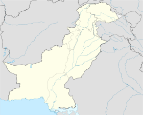
 Dera Ismail Khan