Chiddingstone Hoath
- Chiddingstone Hoath
-
Chiddingstone Hoath est un hameau dans le district de Sevenoaks dans le Kent.
Sur les autres projets Wikimedia :
Wikimedia Foundation.
2010.
Contenu soumis à la licence CC-BY-SA. Source : Article Chiddingstone Hoath de Wikipédia en français (auteurs)
Regardez d'autres dictionnaires:
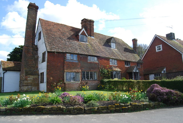
Chiddingstone Hoath — is a hamlet in the Sevenoaks District of Kent, England. Notable buildings include Hoath House, and Stonewall Park, for some time home of the Meade Waldo family. It was visited by Charles Rennie Mackintosh in 1910. Hever Chiddingstone Penshurst … Wikipedia
Chiddingstone — Coordinates: 51°11′10″N 0°08′54″E / 51.186090°N 0.148450°E / 51.186090; 0.148450 … Wikipedia
Chiddingstone Causeway — Coordinates: 51°11′43″N 0°10′28″E / 51.195300°N 0.174450°E / 51.195300; 0.174450 … Wikipedia
Chartwell — For other uses, see Chartwell (disambiguation). Coordinates: 51°14′39″N 0°04′57″E / 51.244090°N 0.082450°E / 51.244090; 0.082450 … Wikipedia
Sevenoaks — For the parliamentary constituency, see Sevenoaks (UK Parliament constituency). For the Community in Wesley Chapel Florida, see Seven Oaks Community. Coordinates: 51°16′41″N 0°11′15″E / … Wikipedia
Otford — For the town of this name in Australia, see Otford, New South Wales. Coordinates: 51°18′35″N 0°11′12″E / 51.30969°N 0.18657°E / 51 … Wikipedia
Marsh Green, Kent — Marsh Green is a small hamlet in Eden Vale, part of the parish of Edenbridge, England. The hamlet was founded in 1554 under its current name. Marsh Green claims the last bare knuckle boxing fight in England, in 1886. External links Marsh Green … Wikipedia
Dunton Green — Coordinates: 51°17′47″N 0°10′18″E / 51.29648°N 0.17160°E / 51.29648; 0.17160 … Wikipedia
New Ash Green — is a village near the ancient village of Ash, in the parish of Ash cum Ridley, about 6 miles (10 km) south of Gravesend in Kent and 21 miles (34 km) south east of London. Building of the village began in 1967, with Span as the developer … Wikipedia
Cowden — For other uses, see Cowden (disambiguation). Coordinates: 51°08′41″N 0°05′36″E / 51.144765°N 0.093459°E / 51.144765; 0.093459 … Wikipedia
 Cottage
 Angleterre
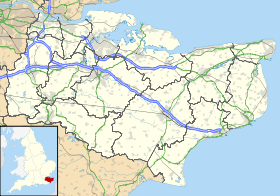
 Chiddingstone Hoath