Chentouf
- Chentouf
-
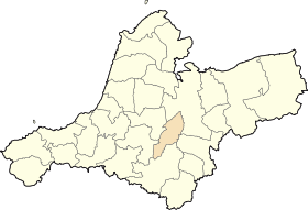
Chentouf, anciennement Le Keroulis, est une commune de la wilaya de Aïn Témouchent en Algérie.
Géographie
Cette section est vide, insuffisamment détaillée ou incomplète.
Votre aide est la bienvenue !
Tanger
Histoire
Cette section est vide, insuffisamment détaillée ou incomplète.
Votre aide est la bienvenue !
Références
Catégorie :
- Commune de la wilaya de Aïn Témouchent
Wikimedia Foundation.
2010.
Contenu soumis à la licence CC-BY-SA. Source : Article Chentouf de Wikipédia en français (auteurs)
Regardez d'autres dictionnaires:
Chentouf — Location of Chentouf within Aïn Témouchent province Coordinates … Wikipedia
Bouchentouf — Le nom doit être décomposé en Bou Chentouf (Chentouf est également un nom de famille en Afrique du Nord). Bou (abû) signifie en principe le père de , mais peut aussi avoir le sens de homme . Quant à Chentouf, le nom existe en kabyle (acentuf)… … Noms de famille
Aïn Témouchent Province — Infobox Algerian Province name1 = Aïn Témouchent name2 = عين تموشنت provincecode = 46 areacode = 27 capital = Aïn Témouchent districts = 8 municipalities = 28 wali = Mr. Bouderbali Mohamed president = Mr. Tikhmarine Lakhdar (FLN) order = 1 E+8 m² … Wikipedia
Nouredine el Fahtni — Born August 15, 1982 (1982 08 15) (age 29) Midar, Morocco Charge(s) Terrorism, Weapon Charges Penalty 5 years and 4 years imprisonment (different cases) … Wikipedia
Communes of Algeria — Algeria This article is part of the series: Politics and government of Algeria Constitution President (List … Wikipedia
Hammam Bou Hadjar District — Infobox Algerian District map1 = DZ 46.svg map2 = Sin mapa.svg name1 = Hammam Bou Hadjar name2 = حمام بوحجر province = Aïn Témouchent capital = Hammam Bou Hadjar municipalities = 4 code = chef = area1 = area2 = population = 46 298 popyear = 1998… … Wikipedia
Chaabet El Ham — Location of the commune within Aïn Témouchent province Coordinates … Wikipedia
Oued Berkeche — Location within Aïn Témouchent province Coordinates … Wikipedia
Oued Sabah — Location within Aïn Témouchent province Coordinates … Wikipedia
Ouled Boudjemaa — Location within Aïn Témouchent province Coordinates … Wikipedia
 Algérie


