Chegworth
- Chegworth
-
Chegworth est un hameau du civil parish de Ulcombe dans le district de Maidstone dans le Kent. Le hameau se trouve le long de la route Chegworth, Chegworth Lane et Water Lane, et ne comporte plus que 20 logements, y compris l'historique Moulin à eau Chegworth sur la Rivière Len.
Sur les autres projets Wikimedia :
Wikimedia Foundation.
2010.
Contenu soumis à la licence CC-BY-SA. Source : Article Chegworth de Wikipédia en français (auteurs)
Regardez d'autres dictionnaires:
Chegworth — is a hamlet in the parish of Ulcombe in the Maidstone District of Kent, England. The hamlet lies along the Chegworth Road, Chegworth Lane and Water Lane, and comprises no more than 20 dwellings, including the historic Chegworth Water Mill on the… … Wikipedia
Medway watermills (lower tributaries) — River Medway (lower tributaries) Legend … Wikipedia
River Len — For an explanation of the various pieces of machinery mentioned, see Mill machinery. Len River Kent rivers, showing the Len … Wikipedia
River Len, Kent — Geobox|River name = Len native name = other name = other name1 = image size = 250px image caption = Kent rivers, showing the Len. etymology = country = England country1 = state = state1 = region = Kent region1 = district = Maidstone district1 =… … Wikipedia
Maidstone — For other uses, see Maidstone (disambiguation). Coordinates: 51°16′19″N 0°31′44″E / 51.272°N 0.529°E / 51.272; 0.529 … Wikipedia
Marden, Kent — Coordinates: 51°10′28″N 0°29′39″E / 51.174477°N 0.494198°E / 51.174477; 0.494198 … Wikipedia
Collier Street — Coordinates: 51°11′22″N 0°27′16″E / 51.189460°N 0.454580°E / 51.189460; 0.454580 … Wikipedia
Detling — Coordinates: 51°17′46″N 0°34′16″E / 51.296°N 0.571°E / 51.296; 0.571 … Wikipedia
Nettlestead, Kent — For Nettlestead in Suffolk, see Nettlestead, Suffolk. Coordinates: 51°14′41″N 0°24′40″E / 51.244600°N 0.411210°E / … Wikipedia
Nettlestead Green — Nettlestead Green, like its near neighbour Nettlestead lies in the Medway valley SW of Maidstone in Kent. It has its own church[citation needed], character village 17th century pub (The Hop Pole Inn) and a plant nursery (Wood Cottage Nursery).… … Wikipedia
 Angleterre
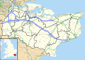
 Chegworth