Birrong
Contenu soumis à la licence CC-BY-SA. Source : Article Birrong de Wikipédia en français (auteurs)
Regardez d'autres dictionnaires:
Birrong, New South Wales — Infobox Australian Place | type = suburb name = Birrong city = Sydney state = nsw caption = Auburn Road, Birrong lga = City of Bankstown postcode = 2143 pop = area = propval = est = stategov = Bankstown fedgov = Blaxland near nw = Sefton near n … Wikipedia
Birrong railway station, Sydney — |servicearea textcolor=black|code=BRG|suburb=Birrong|street=Rodd St|distance=22.11|altitude=?|traintype=Suburban all stops|platforms=2|tracks=2|platform arr=1 Island|stationtype=Ground|gates=None|connect=None|disabled=No facilities=… … Wikipedia
List of Government schools in New South Wales: A–F — The New South Wales Department of Education and Training (DET) is a department of the Government of New South Wales. In addition to other responsibilities, it operates primary schools and secondary schools throughout the state. Contents 1 A 2 B 3 … Wikipedia
Bankstown railway line, Sydney — Public transport infrastructure in Sydney logo= name=Bankstown Line transport mode=Commuter rail line line owner=CityRail operation area=Inner west/west map colour=Orange stations number=27 interchange names=Town Hall Central Sydenham Campsie… … Wikipedia
City of Bankstown — New South Wales Population: 186,108(2009) … Wikipedia
Yagoona, New South Wales — Infobox Australian Place | type = suburb name = Yagoona city = Sydney state = nsw caption = Hume Highway, Yagoona lga = City of Bankstown postcode = 2199 est = 1927 pop = 14,876 (2006 census) density = area = 4.47 propval = stategov = Bankstown… … Wikipedia
Chester Hill, New South Wales — Chester Hill Sydney, New South Wales Nugent Park, Chester Hill Population … Wikipedia
Milperra massacre — The Milperra Massacre was a firearm battle between rival motorcycle gang members on September 2 (Father s Day) 1984, in Milperra, a south western suburb of Sydney. Seven people were killed: six motorcycle gang members and a fourteen year old… … Wikipedia
Milperra, New South Wales — Milperra Sydney, New South Wales Deepwater Park, Georges River, Milperra P … Wikipedia
Potts Hill, New South Wales — Infobox Australian Place | type = suburb name = Potts Hill city = Sydney state = nsw caption = Potts Hill bushland lga = City of Bankstown postcode = 2143 pop = area = propval = est = stategov = Bankstown fedgov = Blaxland near nw = Regents Park… … Wikipedia
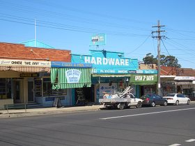 Auburn Road, Birrong
 Australie
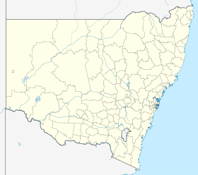
 Birrong


