Abeløya

Abeløya

78° 59′ 20″ N 30° 12′ 20″ E / 78.98888889, 30.20555556


Abeløya
Géographie
Pays Drapeau de Norvège Norvège
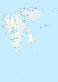
Archipel Svalbard
Localisation Océan Arctique
Coordonnées 78° 59′ 20″ N 30° 12′ 20″ E / 78.98888889, 30.2055555678° 59′ 20″ N 30° 12′ 20″ E / 78.98888889, 30.20555556
Superficie 13,2 km2
Administration
Drapeau de Norvège Norvège
Territoire Svalbard
Autres informations
Fuseau horaire UTC+1

Géolocalisation sur la carte : Svalbard

(Voir situation sur carte : Svalbard)
Abeløya
Abeløya
Îles de Norvège

Abeløya (« l’île Abel ») est une des trois îles principales de l’archipel Kong Karls Land au Svalbard, bien qu’avec une superficie de 13.2 km², elle soit clairement plus petite que les îles Svenskøya et Kongsøya. Depuis 1973, Abeløya fait partie de la réserve naturelle du Nordaustlandet. En 1985, l’accès en a été sévèrement restreint pour protéger la population locale d'ours polaires. L'île est également connue pour les mouettes blanches qui y nichent.

L’île doit son nom au mathématicien norvégien Niels Henrik Abel (1802-1829).

Les premiers à être venus sur cette île sont probablement les participants à l'expédition naturaliste allemande Helgoland placée sous la direction des zoologues Fritz Römer et Fritz Schaudinn, le 2 août 1898.

Sources


Wikimedia Foundation. 2010.

Contenu soumis à la licence CC-BY-SA. Source : Article Abeløya de Wikipédia en français (auteurs)

Игры ⚽ Поможем написать реферат

Regardez d'autres dictionnaires:

  • Abeløya — Vorlage:Infobox Insel/Wartung/Bild fehltVorlage:Infobox Insel/Wartung/Höhe fehlt Abeløya Gewässer Arktischer Ozean Inselgruppe König Karl Land Geographische Lage …   Deutsch Wikipedia

  • Abeløya — Sp Ãbelioja Ap Abeløya L s. Svalbardo ss., Norvegija …   Pasaulio vietovardžiai. Internetinė duomenų bazė

  • Kong Karls Land — Infobox Islands name = King Charles Land image caption = Map of Svalbard, showing Kong Karls Land in the east locator native name = Kong Karls Land native name link = Norwegian language location = Northern Europe coordinates =… …   Wikipedia

  • König-Karl-Land — Satellitenbild Gewässer Arktischer Ozean Archipel …   Deutsch Wikipedia

  • Islas del Rey Carlos — (Kong Karls Land) Imagen de satélite Terra MODIS de las islas del Rey Carlos, Svalbard, 12 de julio de 2002 Localización …   Wikipedia Español

  • Абелёйа — Abeløya …   Википедия

  • List of islands in the Arctic Ocean — This is a list of islands in the Arctic Ocean, classified by country.Canada*Canadian Arctic Archipelago **Queen Elizabeth Islands ***Axel Heiberg Island ***Ellesmere Island ***Devon Island ***Melville Island **Baffin Island **Banks Island… …   Wikipedia

  • Liste norwegischer Inseln — Zu Norwegen gehörende Inseln: Nordatlantik Aldra Andørja Bergsøya Borgundøy Dønna Eigerøya Engeløya Finnkona Fjellbergøya Flekkerøya Frøya Grønnøy Gurskøya Handnesøya Herøya Halsnøy Hitra Hugla Hvasser Ingøy Jan Mayen Jeløya K …   Deutsch Wikipedia

  • Liste von unbewohnten Inseln und Inselgruppen (Arktischer Ozean) — In die Liste von unbewohnten Inseln und Inselgruppen (Arktischer Ozean) gehören nur im Arktischen Ozean (Nordpolarmeer) und seiner Nebenmeere gelegene Inseln oder Inselgruppen, die entweder noch nie von Menschen bewohnt waren oder seit längerer… …   Deutsch Wikipedia

  • Kong Karls Land — 78°45′N 28°30′E / 78.75, 28.5 …   Wikipédia en Français

Share the article and excerpts

Direct link
Do a right-click on the link above
and select “Copy Link”