Yoshinogawa
- Yoshinogawa
-
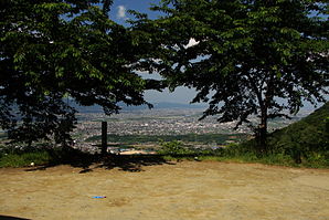
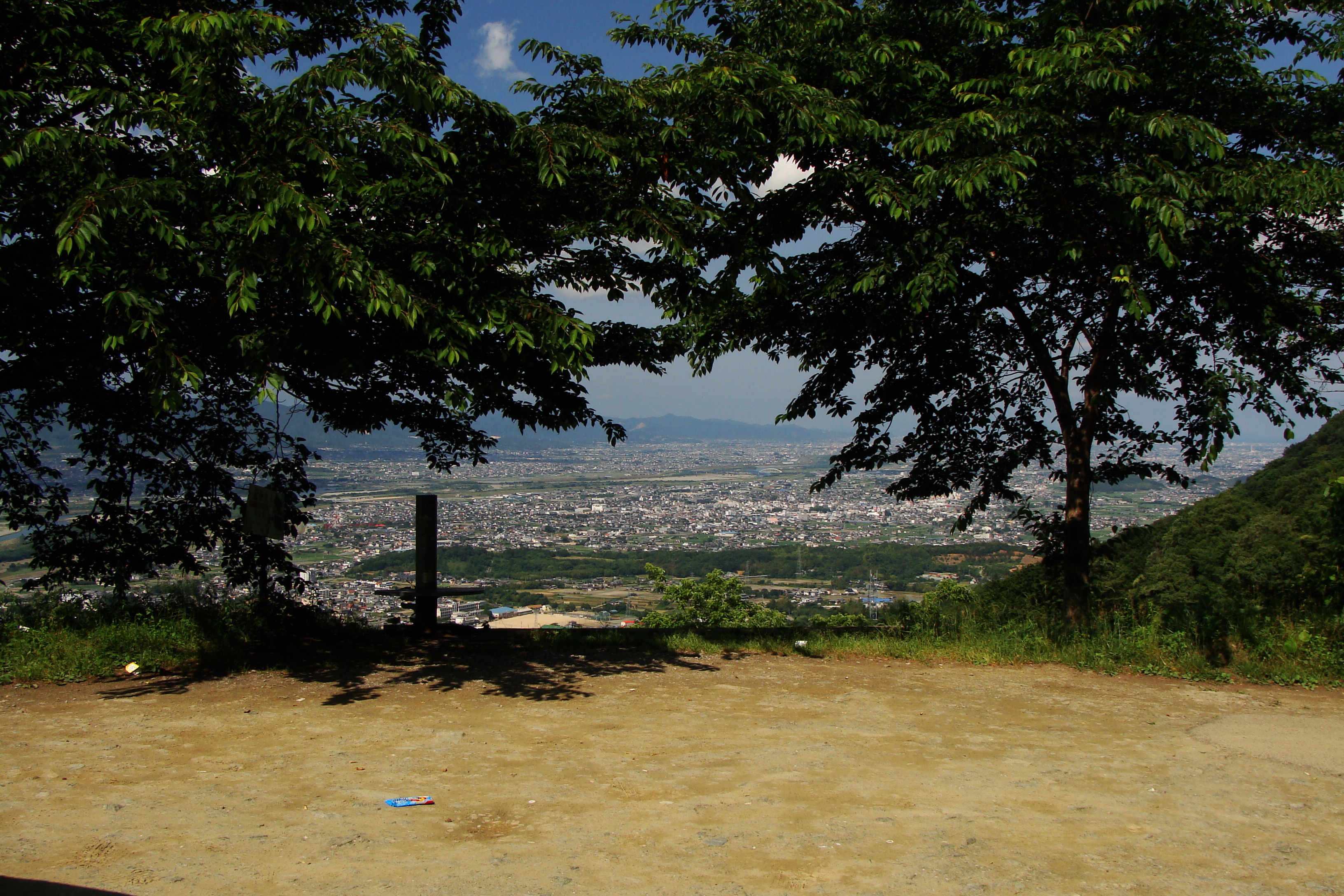
Yoshinogawa (吉野川市, Yoshinogawa-shi?) est une ville du Japon située dans la préfecture de Tokushima.
La ville a été fondée le 1er octobre 2004 de la fusion des villes de Kamojima, Kawashima, Misato et Yamakawa.
La rivière éponyme (Yoshino-gawa) forme la frontière nord de la ville.
Yoshinogawa abrite le Fujiidera (藤井寺), 11e étape du pèlerinage de Shikoku.
Wikimedia Foundation.
2010.
Contenu soumis à la licence CC-BY-SA. Source : Article Yoshinogawa de Wikipédia en français (auteurs)
Regardez d'autres dictionnaires:
Yoshinogawa — shi 吉野川市 … Deutsch Wikipedia
Yoshinogawa, Tokushima — nihongo|Yoshinogawa|吉野川市|Yoshinogawa shi is a city located in Tokushima, Japan.As of October 1, 2004, the city has an estimated population of 47,218 and a density of 327 persons per km². The total area is 144.19 km².The city was founded on… … Wikipedia
Yoshinogawa-shi — Admin ASC 2 Code Orig. name Yoshinogawa shi Country and Admin Code JP.39.7406324 JP … World countries Adminstrative division ASC I-II
4670 Yoshinogawa — Infobox Planet minorplanet = yes width = 25em bgcolour = #FFFFC0 apsis = name = Yoshinogawa symbol = caption = discovery = yes discovery ref = discoverer = T. Seki discovery site = Geisei discovered = December 19, 1987 designations = yes mp name … Wikipedia
Ruta Nacional 192 (Japón) — Saltar a navegación, búsqueda La Ruta Nacional 192 (国道192号, Kokudō 192 gō?) es una ruta que comuni … Wikipedia Español
Aizumi, Tokushima — nihongo|Aizumi|藍住町|Aizumi chō is a town located in Itano District, Tokushima, Japan.Aizumi is situated in the northeast of Tokushima Prefecture. As of 2003, the town has an estimated population of 31,623 and a density of 1,943.64 persons per km² … Wikipedia
Tokushima Prefecture — Infobox Prefecture Japan Name = Tokushima JapaneseName = 徳島県 Rōmaji = Tokushima ken Symbol = PrefSymbol Tokushima.png Capital = Tokushima (city) Region = Shikoku Island = Shikoku TotalArea = 4,144.95 AreaRank = 36th PCWater = 1.5 PopDate =… … Wikipedia
Kamojima, Tokushima — was a town located in Oe District, Tokushima, Japan. On October 1, 2004, Kamojima merged with the towns of Kawashima and Yamakawa, and the village of Misato to form the new city of Yoshinogawa.As of 2003, the town had an estimated population of… … Wikipedia
Kawashima, Tokushima — nihongo|Kawashima|川島町|Kawashima chō was a town located in the former Oe District, Tokushima, Japan. On October 1, 2004, Kawashima merged with the towns of Kamojima and Yamakawa, and the village of Misato to form the city of Yoshinogawa.As of 2003 … Wikipedia
Yamakawa, Tokushima — nihongo|Yamakawa|山川町|Yamakawa chō was a town located in Oe District, Tokushima, Japan. On October 1, 2004, Yamakawa merged with the towns of Kamojima and Kawashima, and the village of Misato to form the city of Yoshinogawa.As of 2003, the town… … Wikipedia