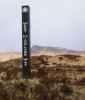
West Highland Way
- West Highland Way
-
| West Highland Way |
 |
| Localisation |
 Écosse Écosse |
| Type |
Scottish Long Distance Route |
| Longueur |
152 km |
| Points de départ |
Milngavie
Fort William |
| Altitude maximale |
Devil's Staircase |
| Difficulté |
Modérée |
| Dangers |
Météorologie |
modifier  |
Le West Highland Way, est un chemin de randonnée en Écosse d'une distance d'environ 152 kilomètres, soit 95 miles qui relie Milngavie, située au nord de Glasgow, à Fort William, dans les Highlands écossais. Environ 85000 personnes empruntent ce sentier chaque année, sur une durée de 5, 6 ou 7 jours. Une course annuelle, appelée "West Highland Way Race", a lieu sur le parcours.
Histoire
Le West Highland Way a été le premier sentier a porter le titre de "Long Distance Route" en Écosse. Son développement a été lancé en 1974 et il a été inauguré le 6 octobre 1980.
Localités traversées
Elles sont listées du sud au nord, avec des distances approximatives.
- Milngavie
- Beech Tree Inn, Glengoyne
- Drymen
- Balmaha, Loch Lomond; 30 km (19 mi)
- Rowardennan, Loch Lomond; 44 km (27 mi)
- Inversnaid, 54 km (34 mi)
- Inverarnan, 64 km (40 mi)
- Crianlarich, 75 km (47 mi)
- Tyndrum, 85 km (53 mi)
- Bridge of Orchy, 95 km (59 mi)
- Inveroran, 99 km (62 mi)
- Kingshouse, 115 km (71 mi)
- Kinlochleven, 130 km (81 mi)
- Fort William, 152 km (95 mi)
Liens externes
Sur les autres projets Wikimedia :
v · National Trails ( Angleterre et Pays de Galles)
Cleveland Way · Cotswold Way · Glyndŵr's Way · Hadrian's Wall Path · North Downs Way · North Norfolk Coastal Path · Offa's Dyke Path · Peddars Way · Pembrokeshire Coast Path · Pennine Bridleway · Pennine Way · The Ridgeway · South Downs Way · South West Coast Path · Thames Path · Yorkshire Wolds Way
|
|
| Long Distance Routes (Écosse) |
Great Glen Way · Southern Upland Way · Speyside Way · West Highland Way
|
Wikimedia Foundation.
2010.
Contenu soumis à la licence CC-BY-SA. Source : Article West Highland Way de Wikipédia en français (auteurs)
Regardez d'autres dictionnaires:
West Highland Way — Der West Highland Way südlich von Fort William Daten Länge 154 km Lage Großbritannien, westliches Schottland … Deutsch Wikipedia
West Highland Way — Infobox Hiking trail Name=West Highland Way Photo=WHW Rannoch Moor.jpg Caption=The sun breaks partially through the clouds in a rainy day on the outskirt of Rannoch Moor in late April 2008 on West Highland Way on the way from Bridge of Orchy to… … Wikipedia
West Highland White Terrier — Infobox Dogbreed altname= Poltalloch Terrier Roseneath Terrier White Roseneath Terrier [ [http://www.trainpetdog.com/West Highland White Terrier/about west highland white terrier.html West Highland White Terrier: Training, History, Temperament,… … Wikipedia
West Highland Line — Glasgow Queen Street–Oban/Mallaig Streckenlänge: 163/264 km Spurweite: 1435 mm (Normalspur) Zweigleisigkeit: nein Legende … Deutsch Wikipedia
Highland (Unitary Authority) — Highland Gàidhealtachd Verwaltungssitz Inverness Fläche 30.659 km² (1.) … Deutsch Wikipedia
Highland (council area) — infobox Scotland council area Council= The Highland Council Sgire Comhairle na Gàidhealtachd SizeRank= 1st Size= 30,659 km² Water= ? AdminHQ= Inverness ISO= GB HLD ONS= 00QT PopulationRank= 7th PopulationDate= 2004 Population= 211,340… … Wikipedia
Highland Park, Los Angeles, California — Highland Park is a district of North East Los Angeles. It includes the Garvanza and San Pasqual neighborhoods, and some would argue, Mt. Washington.Geography and TransportationHighland Park is located along the Arroyo Seco. It is situated within… … Wikipedia
West Virginia Waterways — finds its source at the highland watersheds of the Allegheny Mountains. These watersheds supply drainage to the creeks often passing through deep and narrow hollows. From the hollows, rushing highland streams collect in bottom land brooks and… … Wikipedia
South West Coast Path — The starting point at Minehead Length 630 miles (1,014 km) Location England: Somerset, Devon, Cornwall … Wikipedia
Speyside Way — Der Speyside Way ist einer der vier offiziellen überregionalen Fernwanderwege in Schottland (neben dem West Highland Way, dem Southern Upland Way und dem Great Glen Way). Er wurde 1981 eröffnet und verläuft von der Spey Bay nach Ballindalloch.… … Deutsch Wikipedia

 Écosse
