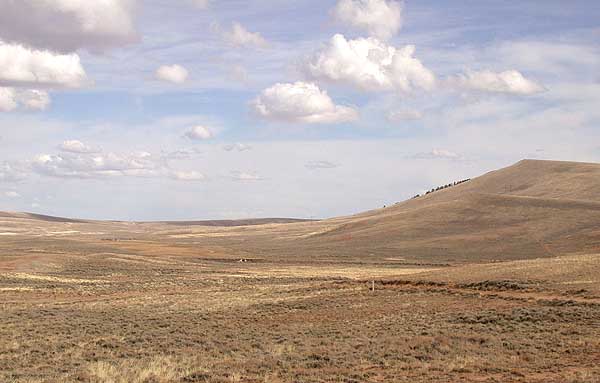
South Pass

South Pass
South Pass
DSCN6109 pacificspringsandsouthpass e 600.jpg
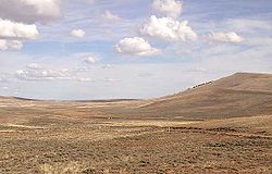
Approche du sommet par l’ouest et vue vers l’est.
Altitude 2 301 m
Massif Chaîne de Wind River / Antelope Hills
Latitude
Longitude
42° 22′ 12″ Nord
       108° 54′ 49″ Ouest
/ 42.37, -108.913611
42° 22′ 12″ N 108° 54′ 49″ W / 42.37, -108.913611
Pays Drapeau des États-Unis États-Unis
Vallées Vallée de ?
(sud-ouest)
Vallée de ?
(nord-est)
Ascension depuis
Farson Lander
Déclivité moy.
Déclivité max.
Kilométrage
54 km
Accès
Wyoming State Highway 28 Wyoming State Highway 28

Géolocalisation sur la carte : Wyoming

(Voir situation sur carte : Wyoming)
South Pass

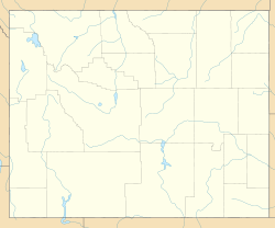
Géolocalisation sur la carte : États-Unis

(Voir situation sur carte : États-Unis)
South Pass

Le South Pass (« col Sud ») est un col de montagne situé sur le Continental Divide près du parc national de Yellowstone dans les montagnes rocheuses dans l’État du Wyoming aux États-Unis.

Il est situé à environ 54 km de la localité de Lander entre les Wind River Range au nord et les Antelope Hills au sud. La route d’état Wyoming State Highway 28 traverse le col. Le col est reconnu comme National Historic Landmark depuis 1961.

Liens externes

Références


Wikimedia Foundation. 2010.

Contenu soumis à la licence CC-BY-SA. Source : Article South Pass de Wikipédia en français (auteurs)

Игры ⚽ Нужна курсовая?

Regardez d'autres dictionnaires:

  • South Pass — x South Pass Am South Pass, Blick Richtung Westen …   Deutsch Wikipedia

  • South Pass — Infobox Mountain Pass Name = South Pass Photo = DSCN6109 pacificspringsandsouthpass e 600.jpg Caption = South Pass, seen from the west looking eastward towards Pacific Springs Elevation = convert|7550|ft|m Location = Wyoming, United States Range …   Wikipedia

  • South Pass City, Wyoming — South Pass City is an unincorporated community located in Fremont County, Wyoming, United States. It is located 2 miles south of the intersection of highways 28 and 131. The closest town is Atlantic City. History South Pass City sprang into… …   Wikipedia

  • South Pass (Luisiana) — Localización de South Pass en el mapa de la Parroquia de Plaquemines. South Pass es una pequeña localidad ubicada sobre el delta del río Misisipi, dentro de la parroquia de Plaquemines, en el estado de Luisiana, Estados Unidos. Geograf …   Wikipedia Español

  • South Pass — geographical name broad valley SW central Wyoming crossing Continental Divide …   New Collegiate Dictionary

  • South Pass — a valley in the Wind River Mountains of southwestern Wyoming that was a major route for settlers moving west through the Rocky Mountains during the 19th century …   Useful english dictionary

  • SOUTH AFRICA — SOUTH AFRICA, republic comprising nine provinces – Western Cape, Eastern Cape, Northern Cape, North West, Gauteng, Limpopo, Mpumalanga, Free State, and KwaZulu Natal. Prior to 1994, when multiracial democracy was introduced, there were four… …   Encyclopedia of Judaism

  • South America — South American. a continent in the S part of the Western Hemisphere. 271,000,000; ab. 6,900,000 sq. mi. (17,871,000 sq. km). * * * Continent, Western Hemisphere. The world s fourth largest continent, it is bounded by the Caribbean Sea to the… …   Universalium

  • South West Coast Path — The starting point at Minehead Length 630 miles (1,014 km) Location England: Somerset, Devon, Cornwall …   Wikipedia

  • South Park: Chef's Luv Shack — Developer(s) Acclaim Publisher(s) …   Wikipedia

Share the article and excerpts

Direct link
Do a right-click on the link above
and select “Copy Link”