Lough Owel
- Lough Owel
-
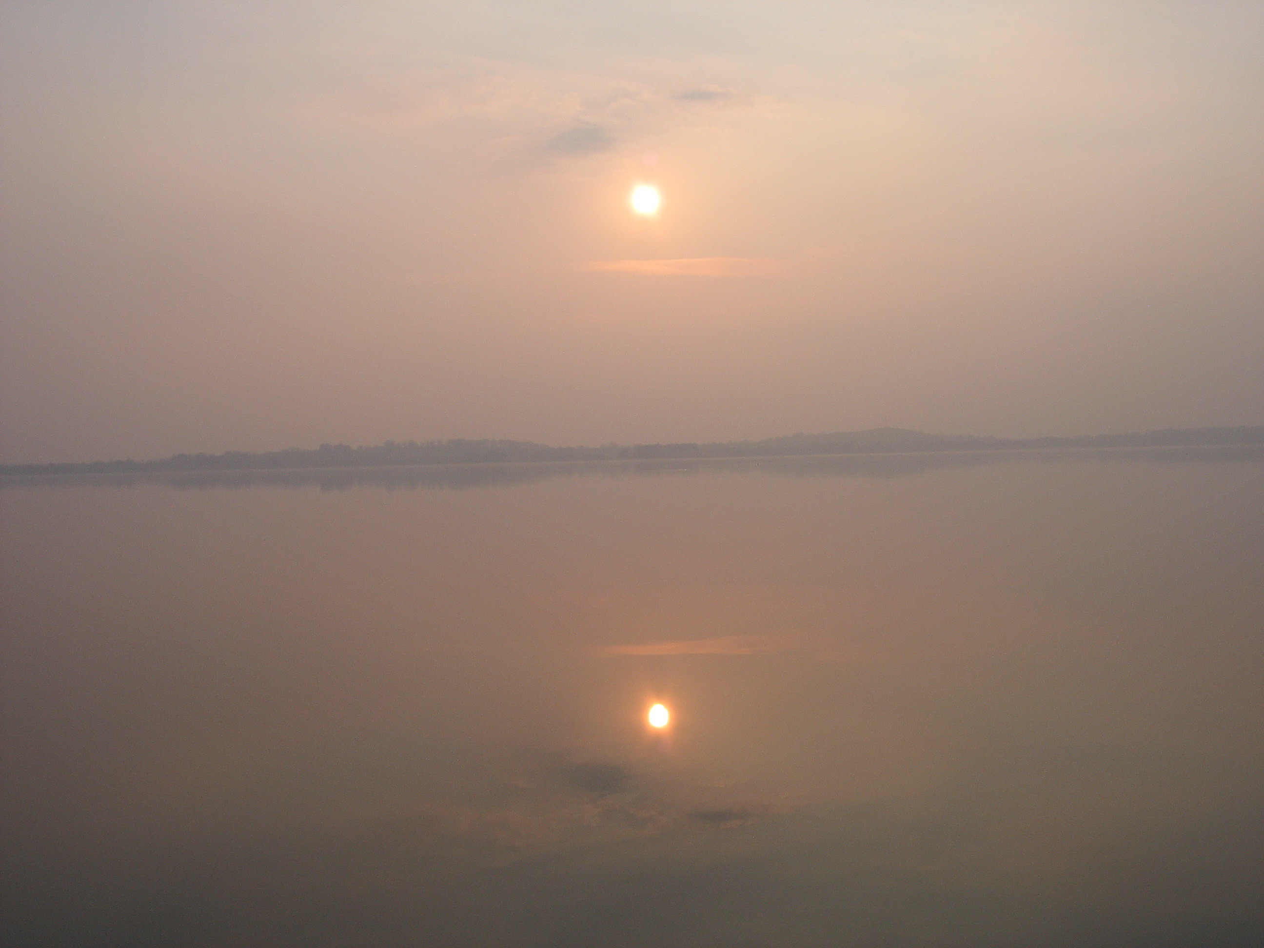
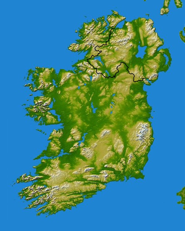
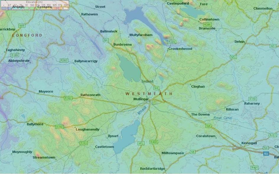
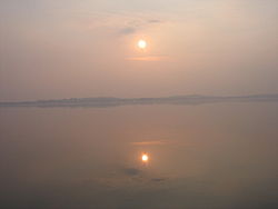
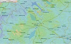
Le Lough Owel est un lac dans les Midlands d'Irlande, situé au nord de Mullingar, une ville du comté de Westmeath. C'est un lac profond, bien connu des pêcheurs, car on y trouve des truites et un peu d'ombles chevaliers. Ses eaux alimentent le canal royal, un canal qui traverse l'Irlande de Dublin au fleuve Shannon. On peut accéder au lac depuis un parking et une jetée situés au sud de la route N4, joignant Mullingar à Longford.
Le Lough Owel et le Lough Ennell sont deux des nombreux lacs appartenant au bassin versant de la rivière Brosna. La Brosna est un affluent du Shannon, traversant Mullingar et Kilbeggan, tous les deux dans le comté de Westmeath, puis la ville de Clara dans le comté d'Offaly, avant de rejoindre le Shannon .
Le chef viking Turgesius fut noyé dans le Lough Owel par Mael Seachnaill Ier mac Mael Ruanaid en 845.
Voir aussi
Source
Wikimedia Foundation.
2010.
Contenu soumis à la licence CC-BY-SA. Source : Article Lough Owel de Wikipédia en français (auteurs)
Regardez d'autres dictionnaires:
Lough Owel — Infobox lake lake name = Lough Owel image lake = Lough Ennel5490s.jpg caption lake = image bathymetry = caption bathymetry = location = County Westmeath basin countries = Ireland coords = coord|53|34|23|N|7|23|18|W|region:IE… … Wikipedia
Lough Owel Lodge B&B — (Муллингар,Ирландия) Категория отеля: 4 звездочный отель Адрес: Culleenmore, М … Каталог отелей
Lough Owell — Lough Owel Lough Owel Lough Owel Administration … Wikipédia en Français
Lough Derravaragh — Infobox lake lake name = Lough Derravaragh Loch Dairbhreach image lake =Knockeyon Deravaragh 07 08 2007.jpg caption lake = Lough Derravaragh viewed from Knockeyon summit image bathymetry = caption bathymetry = location = County Westmeath coords … Wikipedia
Lough Ree — Infobox lake lake name = Lough Ree image lake = IMG LoughRee5750.jpg caption lake = image bathymetry = caption bathymetry = location = Ireland coords = coord|53|30|N|7|58|W|region:IE type:waterbody|display=inline,title type = inflow = River… … Wikipedia
Mullingar — For the place in Canada, see Mullingar, Saskatchewan. Mullingar An Muileann gCearr Town … Wikipedia
Mullingar — Rinné Colman gairé beag searbh Administration Nom irlandais An Muileann gCearr Pays Irlande … Wikipédia en Français
River Brosna — Infobox River | river name = River Brosna caption = River Brosna at Swim Two Birds origin = Near Mullingar, County Westmeath mouth = Shannon at Shannon HarbourThe River Brosna ( ga. An Bhrosnach) is a river in Ireland, flowing through County… … Wikipedia
Liste der Loughs in Irland — Karte mit den Gebirgen, Seen, Flüssen und anderen geologischen Besonderheiten Irlands (größere Version). Dies ist eine Liste der Loughs in Irland. Das Wort Lough kommt aus dem Altirischen und bedeutet See; dies entspricht im Schottischen der… … Deutsch Wikipedia
List of Irish loughs — This is a list of loughs in Ireland. The word lough comes derive|Old Irish|Loch|Lake. It is equivalent to a Scottish loch .There are many minor bodies of water in Ireland, the majority of which are named loughs. The list below contains only those … Wikipedia


 Lough Owel