Harlosh
- Harlosh
-
Harlosh est une île du Royaume-Uni située en Écosse.
Wikimedia Foundation.
2010.
Contenu soumis à la licence CC-BY-SA. Source : Article Harlosh de Wikipédia en français (auteurs)
Regardez d'autres dictionnaires:
Quinn Group — Infobox Company company name = QUINN group company company type = Privately Owned slogan = Strength through Diversity foundation = 1973 location = Derrylin, County Fermanagh, Northern Ireland key people = Sean Quinn, Chairperson num employees = 7 … Wikipedia
Roag — Coordinates: 57°24′15″N 6°32′44″W / 57.40428°N 6.54562°W / 57.40428; 6.54562 … Wikipedia
Raasay — Location … Wikipedia
Cuillin — This article is about the Cuillin of Skye. See Rùm for the Cuillin of Rùm. Sgurr nan Gillean and the Pinnacle Ridge from Basteir gorge The Cuillin (Scottish Gaelic: An Cuilthionn or An Cuiltheann) are a range of rocky mountains located on the… … Wikipedia
Dunvegan Castle — Dunvegan Castle, main entrance … Wikipedia
Dunvegan — For other uses, see Dunvegan (disambiguation). Coordinates: 57°26′N 6°35′W / 57.44°N 6.58°W / 57.44; 6.58 … Wikipedia
Crowlin Islands — Eilean Mòr, Crowlin Islands The Crowlin Islands (Scottish Gaelic: Na h Eileanan Cròlainneach) are a group of uninhabited islands in the Inner Hebrides of Scotland. They lie between Skye and the Applecross peninsula on the mainland. The individual … Wikipedia
Duntulm — Coordinates: 57°41′N 6°20′W / 57.68°N 6.34°W / 57.68; 6.34 … Wikipedia
Isleornsay — Coordinates: 57°08′44″N 5°48′32″W / 57.14569°N 5.80902°W / 57.14569; 5.80902 … Wikipedia
Armadale Castle — ruins Armadale Castle is a ruined country house in Armadale, Isle of Skye, former home of the MacDonalds. A mansion house was first built here around 1790. In 1815 a Scottish baronial style mock castle, intended for show rather than defense,… … Wikipedia
 Royaume-Uni
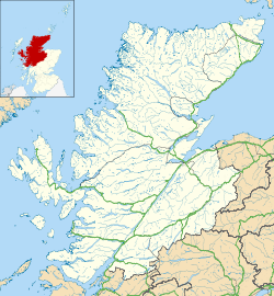
 Harlosh

