Bzovik
- Bzovik
-
Bzovik (en serbe cyrillique : Бзовик) est un village de Serbie situé sur le territoire de la Ville de Kraljevo, district de Raška. En 2002, il comptait 205 habitants[1], dont 203 Serbes (99,02 %)[2].
Démographie
Évolution démographique
| 1948 |
1953 |
1961 |
1971 |
1981 |
1991 |
2002 |
| 341 |
363 |
381 |
375 |
327 |
246 |
205[1] |
Notes et références
- ↑ a et b (sr) Livre 9, Population, analyse comparative de la population en 1948, 1953, 1961, 1971, 1981, 1991 et 2002, données par localités, Institut de statistique de la République de Serbie, Belgrade, mai 2004 (ISBN 86-84433-14-9)
- ↑ (sr) Livre 1, Population, origine nationale ou ethnique, données par localités, Institut de statistique de la République de Serbie, Belgrade, février 2003 (ISBN 86-84433-00-9)
Voir aussi
Articles connexes
Liens externes
Wikimedia Foundation.
2010.
Contenu soumis à la licence CC-BY-SA. Source : Article Bzovik de Wikipédia en français (auteurs)
Regardez d'autres dictionnaires:
Bzovík — (Village) Administration Pays Slovaquie … Wikipédia en Français
Bzovík — Geobox | Settlement name = Bzovík other name = category = Village image caption = Bzovík Castle symbol = etymology = official name = motto = nickname = country = Slovakia country state = region = Banská Bystrica district = Krupina municipality =… … Wikipedia
Kraljevo — Pour les articles homonymes, voir Kraljevo (homonymie). Kraljevo Краљево … Wikipédia en Français
Dolné Mladonice — Krupina in the Banská Bystrica Region Dolné Mladonice (Hungarian: Alsólégénd) is a village and municipality in the Krupina District of the Banská Bystrica Region of Slovakia. History In historical record … Wikipedia
Dolný Badín — Krupina in the Banská Bystrica Region Dolný Badín (Hungarian: Alsóbágyon, earlier Alsóbadin) is a village and municipality in the Krupina District of the Banská Bystrica Region of Slovakia. History The area of the village … Wikipedia
Drážovce (Banská Bystrica) — Coordinates: 48°15′N 18°55′E / 48.25°N 18.917°E / 48.25; 18.917 … Wikipedia
Hont-Pázmány — was the name of a gens ( clan ) in the Kingdom of Hungary. The Gesta Hunnorum et Hungarorum ( Deeds of the Huns and Hungarians ) mentiones that the ancestors of the family (the brothers Hont and Pázmány) arrived, in the late 9th century, to the… … Wikipedia
Liste der Burgen und Schlösser in der Slowakei — Diese Liste führt Burgen und Schlösser in der Slowakei auf. Übersetzungen: hrad, (hrádok) = Burg zámok = Schloss; pevnosť = Festung kaštieľ = Kastell Altes Schloss (slowakisch Starý zámok Banská Štiavnica) Schloss Altsohl (slowakisch Zvolenský… … Deutsch Wikipedia
Liste von Burgen und Schlössern in der Slowakei — Diese Liste führt Burgen und Schlösser in der Slowakei auf. Übersetzungen: hrad, (hrádok) = Burg zámok = Schloss; pevnosť = Festung kaštieľ = Kastell Altes Schloss (slowakisch Starý zámok Banská Štiavnica) Schloss Altsohl (slowakisch Zvolenský… … Deutsch Wikipedia
Dolné Mladonice — (Village) Administration Pays Slovaquie … Wikipédia en Français
 Serbie
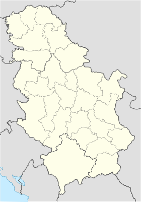
 Bzovik