Boelensloane
Contenu soumis à la licence CC-BY-SA. Source : Article Boelensloane de Wikipédia en français (auteurs)
Regardez d'autres dictionnaires:
Achtkarspelen — Infobox Settlement official name = Achtkarspelen image seal size = 70px mapsize = 280px subdivision type = Country subdivision name = Netherlands subdivision type1 = Province subdivision name1 = Friesland area footnotes = (2006) area total km2 =… … Wikipedia
Boelenslaan — Infobox Settlement official name = Boelenslaan mapsize = 280px subdivision type = Country subdivision name = flagicon|Netherlands Netherlands subdivision type1 = Province subdivision name1 = flagicon|Friesland Friesland settlement type = Village… … Wikipedia
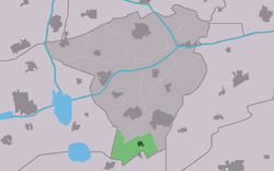
Boelenslaan — 53°9′43″N 6°8′41″E / 53.16194, 6.14472 … Wikipédia en Français
Boelenslaan — Original name in latin Boelenslaan Name in other language Boelenslaan, Boelensloane, Surhuisterveensterheide State code NL Continent/City Europe/Amsterdam longitude 53.1617 latitude 6.14479 altitude 4 Population 1200 Date 2008 10 23 … Cities with a population over 1000 database
 Pays-Bas
 Portail des Pays-Bas