Ravenstonedale
- Ravenstonedale
-

L'église de Ravenstonedale.
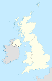
Ravenstonedale est un village et une commune de Cumbrie (Angleterre), sur la ligne de partage des eaux entre la River Lune et la River Eden. La commune est divisée en quatre parties : le centre-ville, Newbiggin-on-Lune, Bowderdale et Fell End.
L'église, dédiée à Saint Oswald de Northumbrie, date du XVIIIe siècle et possède un intérieur intéressant, dans le style collégial, où les rangées de bancs font face à l'allée centrale. Au nord se trouvent les restes d'une abbaye de l'Ordre de Saint-Gilbert construite au XIIe siècle.
Le village était autrefois desservie par la Gare de Ravenstonedale.
Liens externes
Wikimedia Foundation.
2010.
Contenu soumis à la licence CC-BY-SA. Source : Article Ravenstonedale de Wikipédia en français (auteurs)
Regardez d'autres dictionnaires:
Ravenstonedale — is a village and large parish in Cumbria, on the watershed between the River Lune and River Eden. It is divided into four angles, Town, Newbiggin on Lune, Bowderdale and Fell End.The church, dedicated to St Oswald, dates mainly from the 18th… … Wikipedia
Ravenstonedale railway station — was situated on the South Durham Lancashire Union Railway between Tebay and Kirkby Stephen East. It served the villages of Ravenstonedale and Newbiggin on Lune. The station opened to passenger traffic on 8th August 1861, and closed on 1st… … Wikipedia
Gare de Ravenstonedale — La Gare de Ravenstonedale se situait sur la ligne South Durham Lancashire Union Railway entre la gare de Tebay et la Gare de Kirkby Stephen est. Elle desservait les villages de Ravenstonedale et Newbiggin on Lune. Elle ouvre aux passagers le 8… … Wikipédia en Français
Percy F. Frankland — Percy Faraday Frankland FRS (3 October 1858 28 October 1946) was a British chemist. He was the son of Edward Frankland.External links* [http://www.kk.ravenstonedale.org/frankland/index.htm Ravenstonedale community web site, Ravenstonedale, Kirkby … Wikipedia
River Lune — Geobox|River name = Lune native name = other name = other name1 = image size = 300 image caption = The Lune , with the local road, M6 motorway, and West Coast Main Line railway sharing the valley with the river country = England country1 = state … Wikipedia
Kirkby Stephen — infobox UK place country = England latitude= 54.4716 longitude= 2.3479 official name= Kirkby Stephen population = 1,832 shire district= Eden shire county = Cumbria region= North West England constituency westminster= Penrith and The Border post… … Wikipedia
Toby Twirl — is a cartoon character created by children s author Sheila Hodgetts for her publisher, Sampson Low, Marston Co. Ltd. during the 1940s and 1950s. All of the stories are illustrated by Edward Jeffrey. The first book, Toby in Pogland , was produced… … Wikipedia
Civil parishes in Cumbria — A map of Cumbria, showing the districts: (1) Barrow in Furness; (2) South Lakeland; (3) Copeland; (4) Allerdale; (5) Eden; and (6) Carlisle. A civil parish is a subnational entity, forming the lowest unit of local government in England. There are … Wikipedia
List of abbeys and priories in England — Contents 1 Overview 1.1 Article layout 2 Abbreviations and key … Wikipedia
Kirkby Stephen — Kirkby Stephen … Wikipédia en Français
 Angleterre

