- North Tuddenham
-
North Tuddenham 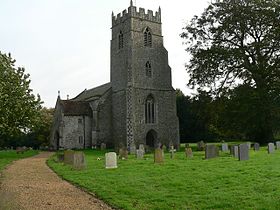
Église Sainte-Marie

Localisation de la communeAdministration Pays Royaume-Uni Nation  Angleterre
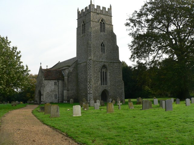
Comté Norfolk District Breckland Statut Civil parish[1] (?) Force de police Norfolk Constabulary Site web Consulter Géographie Coordonnées Superficie 9,41 km² Altitude mini. ? m — maxi. ? m Autres informations Population 305 hab. (United Kingdom Census 2001[2]) Densité 32 hab./km² Code postal NR9 North Tuddenham est une paroisse civile du comté de Norfolk en Angleterre. Elle a une église paroissiale : St Mary's[3].
Références
- A Vision of Britain through Time.
- Census population and household counts for unparished urban areas and all parishes. Office for National Statistics & Norfolk County Council (2001).
- GENUKI: Norfolk: North Tuddenham
Sources
- (en) Cet article est partiellement ou en totalité issu de l’article de Wikipédia en anglais intitulé « North Tuddenham » (voir la liste des auteurs)
Liens externes
- North Tuddenham sur le site Norfolk Churches.
Catégories :- Norfolk
- Village du Norfolk

Wikimedia Foundation. 2010.