Lőportárdűlő

Lőportárdűlő
Lőportárdűlő
Administration
Pays Drapeau de Hongrie Hongrie
Ville Budapest
Géographie
Coordonnées 47° 31′ 15″ N 19° 03′ 54″ E / 47.520881, 19.06501347° 31′ 15″ Nord
       19° 03′ 54″ Est
/ 47.520881, 19.065013
  

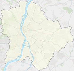
Géolocalisation sur la carte : Budapest

(Voir situation sur carte : Budapest)
Lőportárdűlő

Géolocalisation sur la carte : Hongrie

(Voir situation sur carte : Hongrie)
Lőportárdűlő

Lőportárdűlő (/ˈløːpoɾtaːɾdyːløː/) est un quartier situé dans le 13e arrondissement de Budapest à proximité du quartier d'Angyalföld.


Wikimedia Foundation. 2010.

Contenu soumis à la licence CC-BY-SA. Source : Article Lőportárdűlő de Wikipédia en français (auteurs)

Игры ⚽ Поможем сделать НИР

Regardez d'autres dictionnaires:

  • Angyalföld — ( de. Engelsfeld; literally: Angel s Field ) is a neighbourhood in Budapest, Hungary. Administratively it belongs to District 13th. The traditionally working class neighbourhood went through a process of gentrification due to the office building… …   Wikipedia

  • 13e arrondissement de Budapest — Angyalföld 13e arrondissement de Budapest Pózsonyi út …   Wikipédia en Français

Share the article and excerpts

Direct link
Do a right-click on the link above
and select “Copy Link”