Kapingamarangi
- Kapingamarangi
-

Pour l’article homonyme, voir Kapingamarangi (langue).
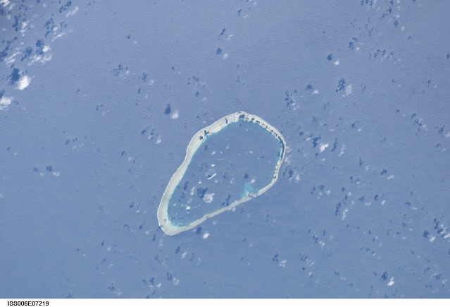
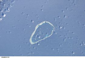
Kapingamarangi est un atoll de Micronésie dont il constitue le point le plus méridional. Contrairement au reste du pays qui est inclus dans l'ensemble géographique de la Micronésie en constituant les îles Carolines, Kapingamarangi est rattaché culturellement à la Polynésie bien qu'il ne fasse partie d'aucun archipel.
Wikimedia Foundation.
2010.
Contenu soumis à la licence CC-BY-SA. Source : Article Kapingamarangi de Wikipédia en français (auteurs)
Regardez d'autres dictionnaires:
Kapingamarangi — ISS Bild von Kapingamarangi Gewässer Pazifischer Ozean Archipel … Deutsch Wikipedia
Kapingamarangi — is an atoll and a municipality in the state of Pohnpei of the Federated States of Micronesia. It is by far the most southerly atoll or island of the country and of Micronesia and of the Caroline Islands, 300 km south of the next southerly atoll,… … Wikipedia
Kapingamarangi — Localización … Wikipedia Español
Kapingamarangi — 1. noun a) An atoll in the Pacific Ocean. b) The Austronesian language spoken in the Federated States of Micronesia, especially by the inhabitants of Kapingamarangi. 2. adjective Of or pertaining to the Kapingamarangi atoll or the Kapingamarangi… … Wiktionary
Kapingamarangi — Original name in latin Kapingamarangi Name in other language State code FM Continent/City Pacific/Pohnpei longitude 1.07861 latitude 154.80752 altitude 11 Population 0 Date 2010 12 21 … Cities with a population over 1000 database
Kapingamarangi language — Kapingamarangi is an Austronesian language spoken in the Federated States of Micronesia. It has about 3 000 native speakers. The language is closely related to the Nukuoro language … Wikipedia
Kapingamarangi Municipality — Admin ASC 2 Code Orig. name Kapingamarangi Municipality Country and Admin Code FM.02.KP FM … World countries Adminstrative division ASC I-II
Kapingamarangi — ISO 639 3 Code : kpg ISO 639 2/B Code : ISO 639 2/T Code : ISO 639 1 Code : Scope : Individual Language Type : Living … Names of Languages ISO 639-3
Kapingamarangische Sprache — Kapingamarangi Gesprochen in Föderierte Staaten von Mikronesien (Bundesstaat Pohnpei) Sprecher ca. 3000 Linguistische Klassifikation Austronesische Sprachen Malayo Polynesisch Ost Malayo Polynesisch … Deutsch Wikipedia
Oroluk (Atoll) — Vorlage:Infobox Insel/Wartung/Höhe fehlt Oroluk Atoll Karte des Oroluk Atolls Gewässer Pazifischer Ozean Archipel … Deutsch Wikipedia
 Micronésie
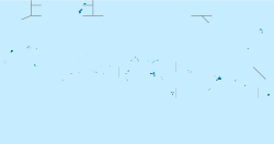
 Kapingamarangi