Ipeľský Sokolec

Ipeľský Sokolec
Ipeľský Sokolec
(Village)
Administration
Pays Drapeau de Slovaquie Slovaquie
Région Région de Nitra
District District de Levice
Code postal 935 75
Plaque minéralogique LV
Starosta (maire) Arnold Ozsvald ( Indépendant )

Mandat: 2013

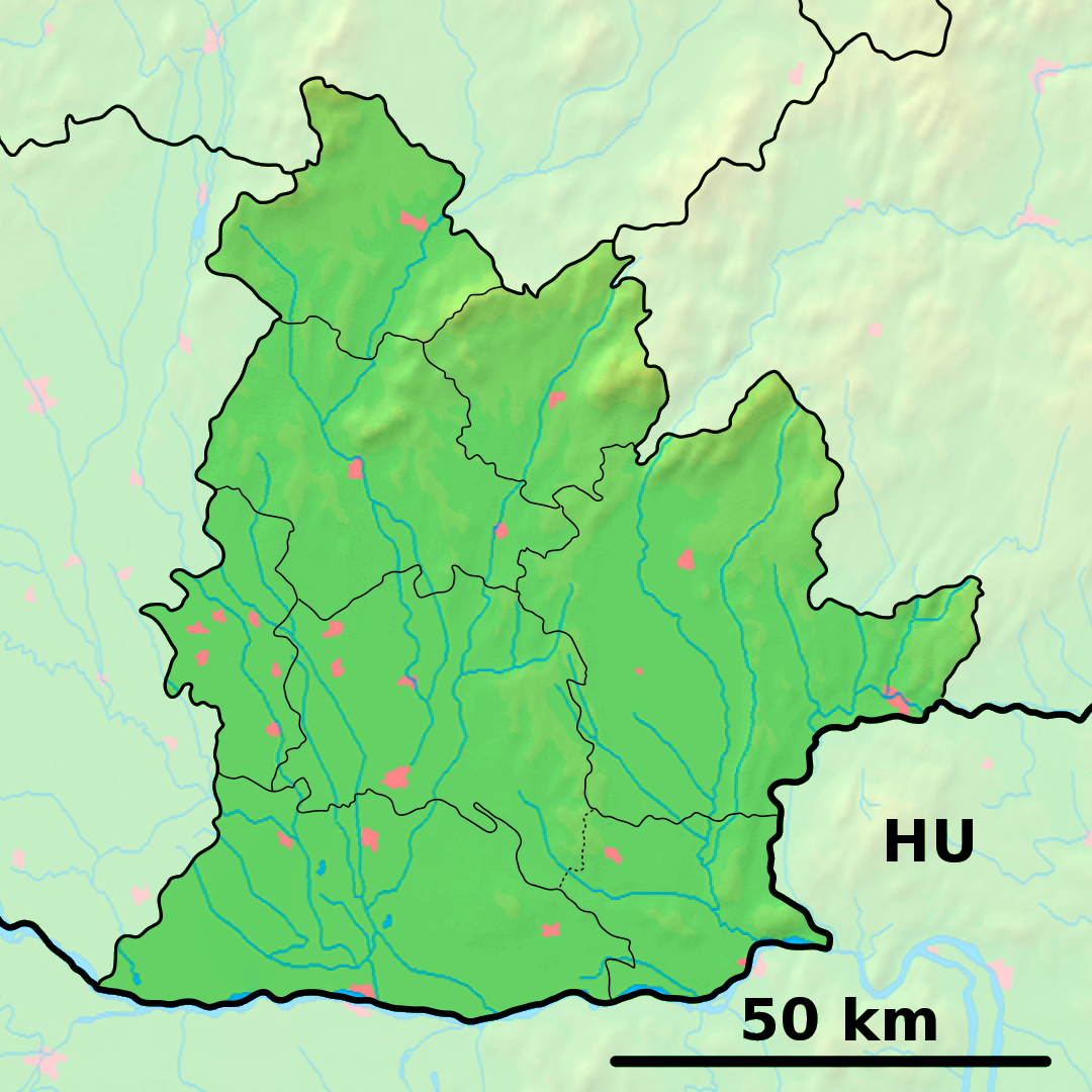
Démographie
Population 867 hab. (31.12.2007)
Densité 47,8 hab./km2
Géographie
Coordonnées 48° 01′ 00″ Nord
       18° 48′ 22″ Est
/ 48.016667, 18.806111
Altitude 119 m
Superficie 1 814,8471 ha = 18,148471 km²
Localisation en Slovaquie
Voir la carte physique
Localisation de la ville
Ipeľský Sokolec
Voir la carte administrative
Localisation de la ville
Ipeľský Sokolec
Localisation dans la région de Nitra
Voir la carte physique
Localisation de la ville
Ipeľský Sokolec
Voir la carte administrative
Localisation de la ville
Ipeľský Sokolec
Sources
Resultat des élections
http://www.e-obce.sk [1]
http://www.statistics.sk [2]
http://www.slovakregion.sk/ [3]

Ipeľský Sokolec (hongrois : Ipolyszakállos)[4] est un village de Slovaquie situé dans la région de Nitra.

Histoire

Première mention écrite du village en 1386.

La localité fut annexée par la Hongrie après le premier arbitrage de Vienne le 2 novembre 1938. En 1938, on comptait 1 220 habitants dont 11 d'origine juive. Elle faisait partie du district de Šahy (hongrois : Ipolysági járás). Le nom de la localité avant la Seconde Guerre mondiale était Sakáloš/Szakállos. Durant la période 1938 - 1945, le nom hongrois Ipolyszakállos était d'usage[5]. À la libération, la commune a été réintégrée dans la Tchécoslovaquie reconstituée.

Notes et références


Wikimedia Foundation. 2010.

Contenu soumis à la licence CC-BY-SA. Source : Article Ipeľský Sokolec de Wikipédia en français (auteurs)

Игры ⚽ Нужно сделать НИР?

Regardez d'autres dictionnaires:

  • Ipeľský Sokolec — ( hu. Ipolyszakállos) is a village and municipality in the Levice District in the Nitra Region of Slovakia.HistoryIn historical records the village was first mentioned in 1386.GeographyThe village lies at an altitude of 116 metres and covers an… …   Wikipedia

  • District de Levice — Levice Informations Pays …   Wikipédia en Français

  • Poiplie — Die Region Poiplie (slowakisch Ipeľský región (cestovného ruchu); deutsch etwa „Eipel Region“) ist eine Tourismusregion in der Slowakei. Sie erstreckt sich dem Lauf des Flusses Ipeľ folgend über die Bezirke: Krupina Veľký Krtíš Lučenec Poltár… …   Deutsch Wikipedia

  • Nitra Region — Coordinates: 48°18′25″N 18°05′11″E / 48.30694°N 18.08639°E / 48.30694; 18.08639 …   Wikipedia

  • Levice District —   District   Country Slovakia Re …   Wikipedia

  • List of municipalities and towns in Slovakia — Slovakia This is a comprehensive list of municipalities and towns in Slovakia. For lists of towns and municipalities sorted by Regions see the individual articles on Regions. For an outdated list of towns only in Slovakia see also List of towns… …   Wikipedia

  • Demandice — Location of Levice District in the Nitra Region Demandice is a village and municipality in the Levice District in the Nitra Region of south west Slovakia. Contents …   Wikipedia

  • Devičany — Location of Levice District in the Nitra Region Devičany is an old village and municipality in the Levice District in the Nitra Region of Slovakia. Contents …   Wikipedia

  • Dolná Seč — Location of Levice District in the Nitra Region Dolná Seč (Hungarian: Alsószecse) is a village and municipality in the Levice District in the Nitra Region of Slovakia …   Wikipedia

  • Dolné Semerovce — Location of Levice District in the Nitra Region Dolné Semerovce (Hungarian: Alsószemeréd) is a village and municipality in the Levice District in the Nitra Region of Slovakia …   Wikipedia

Share the article and excerpts

Direct link
Do a right-click on the link above
and select “Copy Link”