Gyomaendrőd
- Gyomaendrőd
-
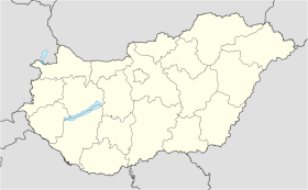
Gyomaendrőd est une ville et une commune du comitat de Békés en Hongrie.
Géographie
Cette section est vide, insuffisamment détaillée ou incomplète.
Votre aide est la bienvenue !
Histoire
Cette section est vide, insuffisamment détaillée ou incomplète.
Votre aide est la bienvenue !
Catégories :
- Ville et village du comitat de Békés
- Ville de Hongrie
Wikimedia Foundation.
2010.
Contenu soumis à la licence CC-BY-SA. Source : Article Gyomaendrőd de Wikipédia en français (auteurs)
Regardez d'autres dictionnaires:
Gyomaendröd — Gyomaendrőd Hilfe zu Wappen … Deutsch Wikipedia
Gyomaendrőd — Gyomaendrőd … Deutsch Wikipedia
Gyomaendrőd — [ thumb|right|300px|Location of Békéscounty in Hungary] Gyomaendrőd is a town in Békés county, in the Southern Great Plain region of south east Hungary. It is located at around coor dms|46|55|60|N|20|49|60|E.HistoryThe smaller towns of Gyoma and… … Wikipedia
Gyomaendrod — Original name in latin Gyomaendrd Name in other language Endrod, Endrd, Gyoma, Gyomaendrod, Gyomaendrd State code HU Continent/City Europe/Budapest longitude 46.93333 latitude 20.83333 altitude 83 Population 15194 Date 2012 01 18 … Cities with a population over 1000 database
Gyomaendrőd — Sp Diòmaendrėdas Ap Gyomaendrőd L Vengrija … Pasaulio vietovardžiai. Internetinė duomenų bazė
Gyomaendrőd — … Википедия
Gyomaendrod — … Википедия
Endröd — Gyomaendrőd Hilfe zu Wappen … Deutsch Wikipedia
Endrőd — Gyomaendrőd Hilfe zu Wappen … Deutsch Wikipedia
Gyoma — Gyomaendrőd Hilfe zu Wappen … Deutsch Wikipedia

 Hongrie


